
ဝှာင်:PIA11176 - A Recent Cluster of Impacts.jpg

ဝှာင် တမ်မူလ (၂၇၃၆ × ၁၈၂၄ pixels, file size: ၅၆၉ KB, MIME type: image/jpeg)
သကေမ်
| ကဵုယၟု |
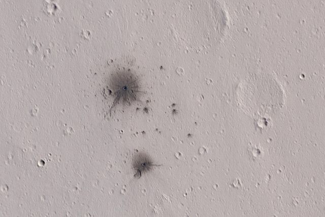
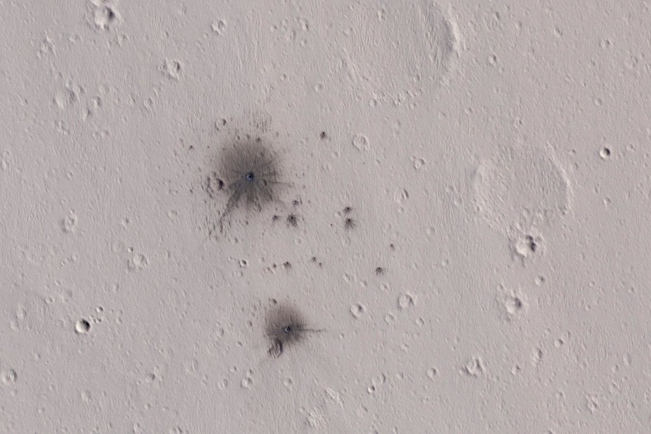
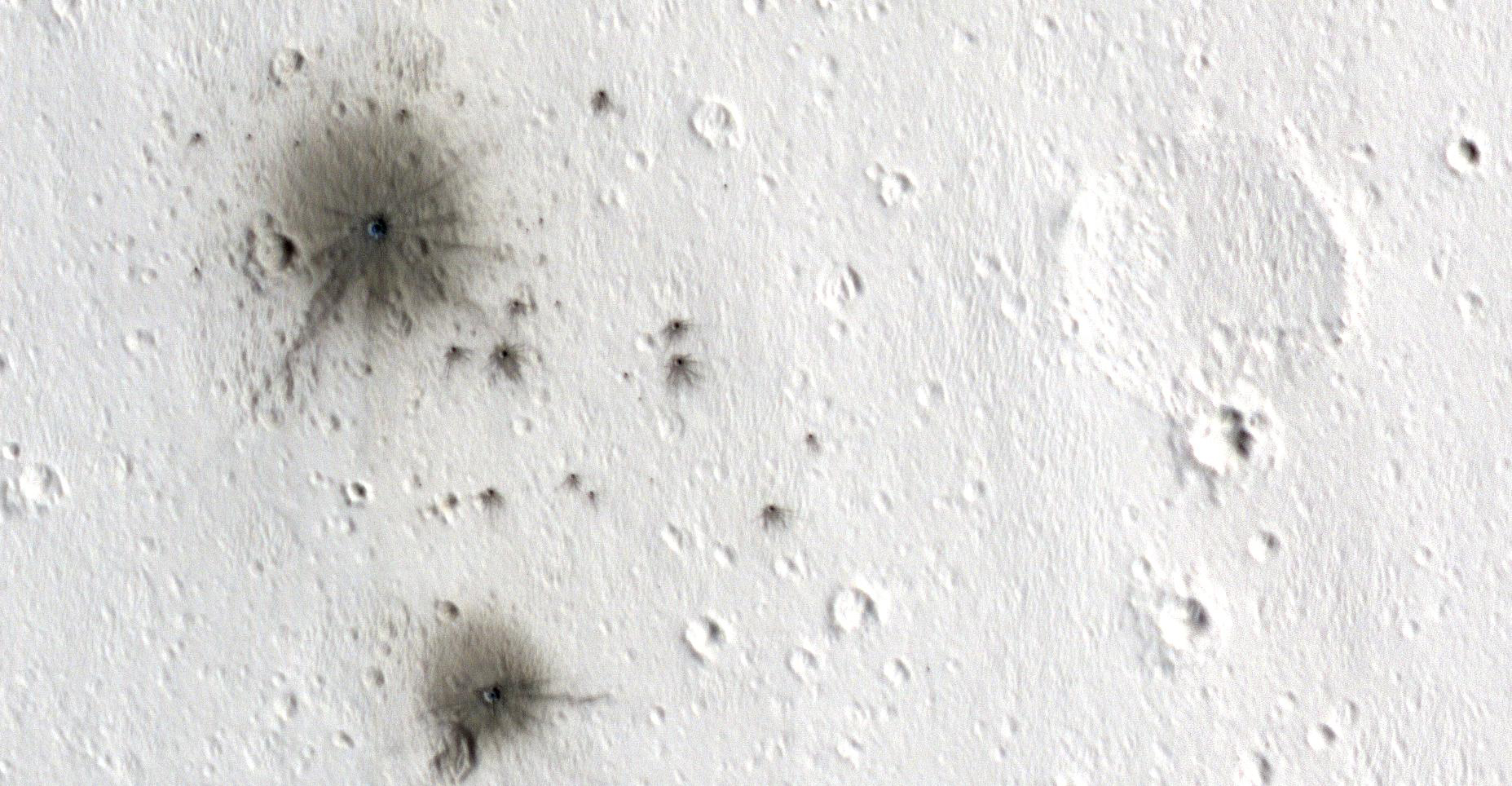
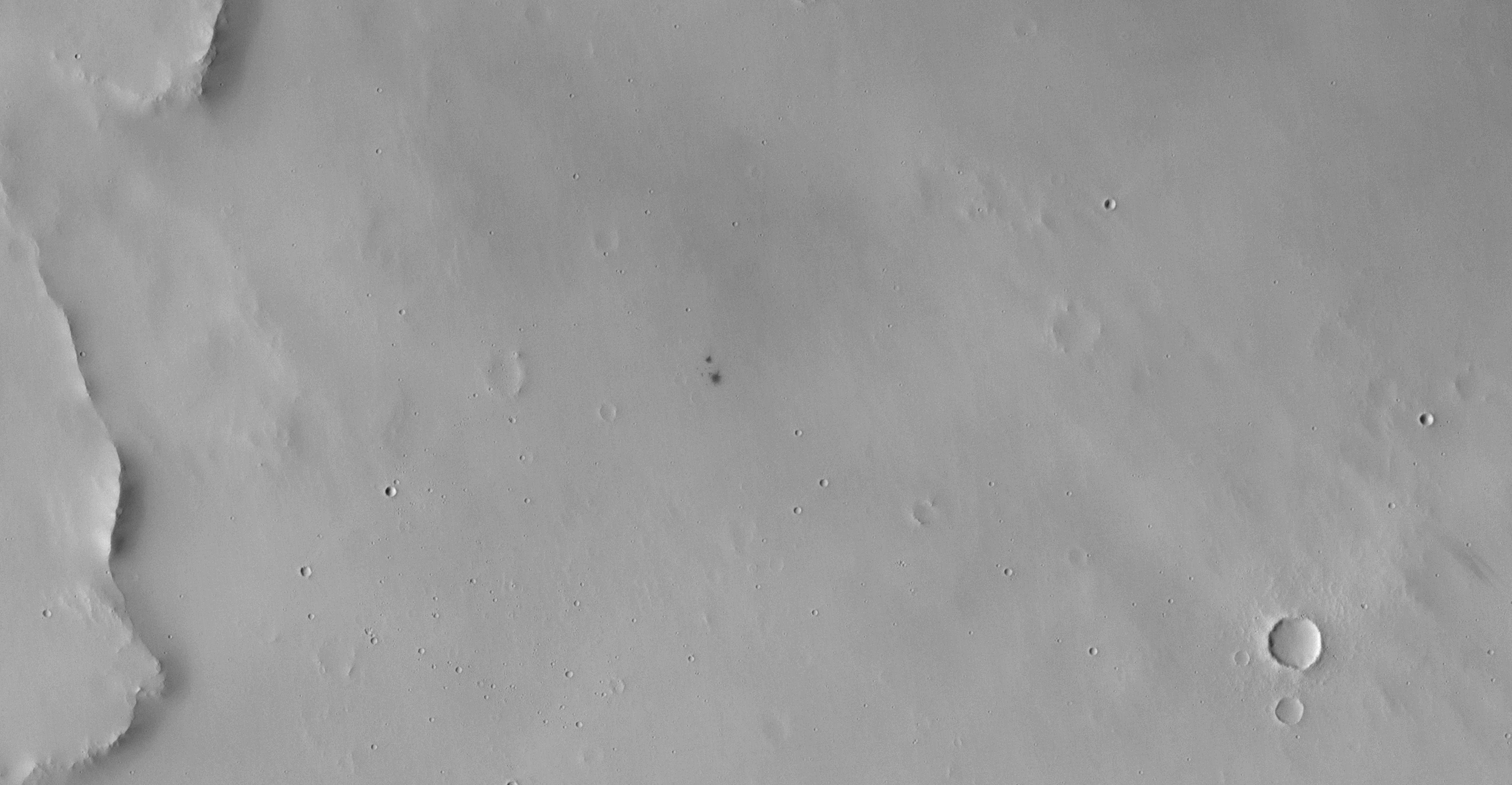
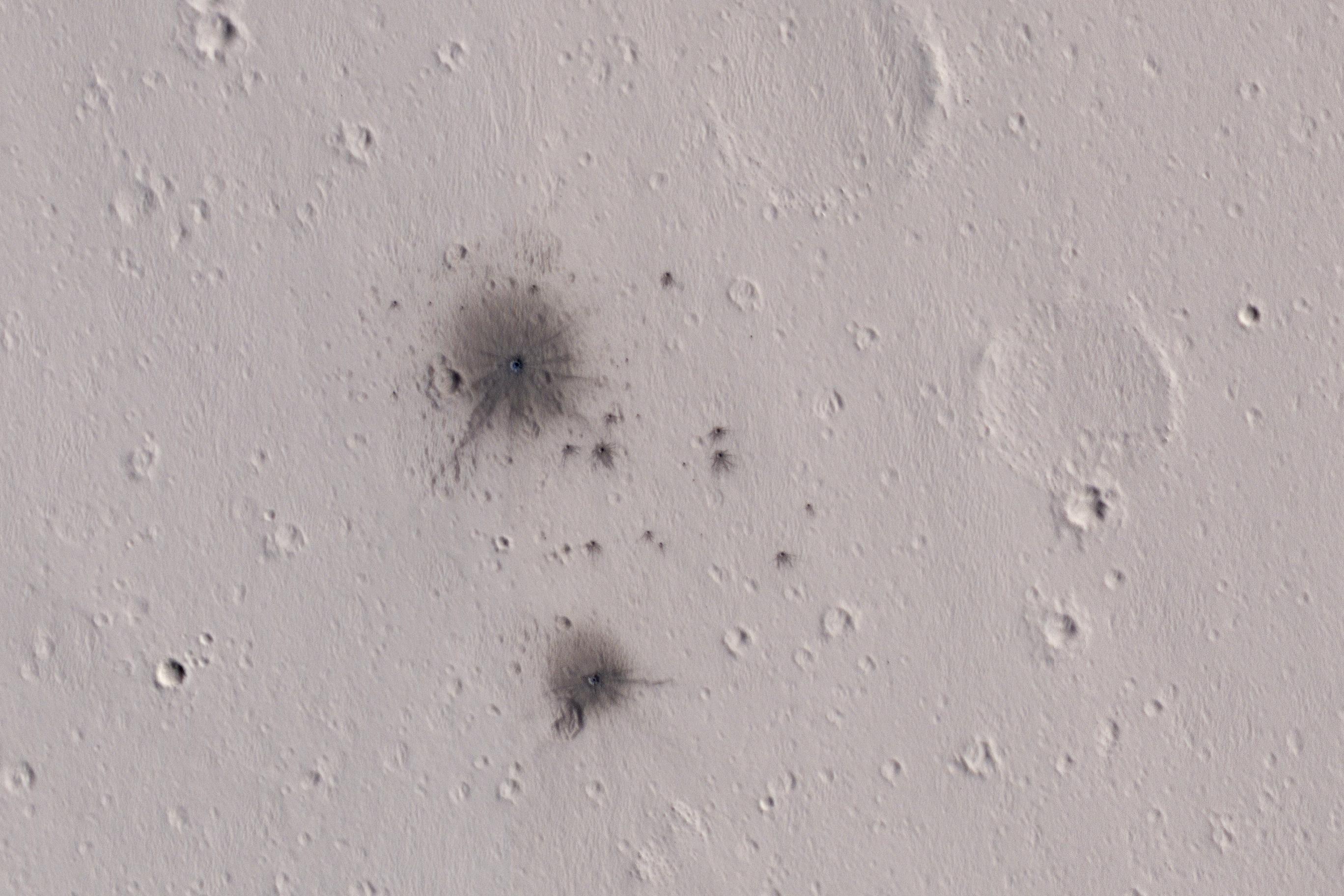
English: The dark spots in this enhanced-color infrared image are the recent impact craters that occurred in the Tharsis region between 2008 and 2014. These impact craters were first discovered by the Mars Context Camera (or CTX, also onboard the Mars Reconnaissance Orbiter) as a cluster of dark spots. The meteoroid that formed these craters must have broken up upon atmospheric entry and fragmented into two larger masses along with several smaller fragments, spawning at least twenty or so smaller impact craters.
The dark halos around the resulting impact craters are a combination of the light-toned dust being cleared from the impact event and the deposition of the underlying dark toned materials as crater ejecta. The distribution and the pattern of the rayed ejecta suggests that the meteoroid most-likely struck from the south (which is up in the cutout). HiRISE frequently monitors new impact craters similar to this one; however, this is the first image of this particular impact taken by HiRISE, thanks to a request by the CTX team. Subsequent images will likely follow to monitor if there are any changes to the site from wind-blown activity or dust-deposition over time. The University of Arizona, Tucson, operates HiRISE, which was built by Ball Aerospace & Technologies Corp., Boulder, Colo. NASA's Jet Propulsion Laboratory, a division of Caltech in Pasadena, California, manages the Mars Reconnaissance Orbiter Project for NASA's Science Mission Directorate, Washington. |
| စၟတ်တ္ၚဲ | 4 October 2016 (published 7 February 2016) |
| တမ်ရိုဟ် | Catalog page · Full-res (JPEG · TIFF) |
| ကဝိ | NASA/JPL-Caltech/Univ. of Arizona |
| Location on Mars | View this and other nearby images on: Google Maps |
|---|
This image or video was catalogued by Jet Propulsion Laboratory of the United States National Aeronautics and Space Administration (NASA) under Photo ID: PIA11176. This tag does not indicate the copyright status of the attached work. A normal copyright tag is still required. See Commons:Licensing. Other languages:
|
 |
This media is a product of the Mars Reconnaissance Orbiter mission Credit and attribution belongs to the High Resolution Imaging Science Experiment (HiRISE) team, NASA/JPL-Caltech/Univ. of Arizona |
မသ္ဂုတ်သွာတ်လာင်ဇြေန်
| This file is in the public domain in the United States because it was solely created by NASA. NASA copyright policy states that "NASA material is not protected by copyright unless noted". (See Template:PD-USGov, NASA copyright policy page or JPL Image Use Policy.) | ||
 |
Warnings:
|
ဝှာင် လၟေင်အပြံင်အလှာဲ
ဍဵု လတူ စၟတ်တ္ၚဲ/အခိင် မွဲမွဲ သွက်ဂွံ ထ္ၜးကဵု ဝှာင် မကတဵုဒှ်လဝ် ပ္ဍဲအခိင်ဂှ်၊၊
| စၟတ်တ္ၚဲ/အခိင် | ဗီုပြင်နမူနာ | ပမာဏ | ညးလွပ် | တင်ပသောင်ကလး | |
|---|---|---|---|---|---|
| လၟုဟ် | ၀၇:၂၉၊ ၉ ဖေဖဝ်ဝါရဳ ၂၀၁၇ | | ၂၇၃၆ × ၁၈၂၄ (၅၆၉ KB) | PhilipTerryGraham | User created page with UploadWizard |
ဝှာင် ဗီုဂွံစကာ
အရာမဆက်ဗက်ကၠုင် page links ကုဝှာင်ဏအ် ဂမၠိုင်ဂှ် -
ဝှာင် သွက်ဂွံသုင်စောဲ ဂလုပ်ဗဴ
ဗွဲသၟဝ်ဏအ်ဂှ် ဒှ်အရာ ဝဳကဳတၞဟ် မစကာလဝ် ဝှာင်ဏအ်၊၊
- ဗီုစကာ ပ္ဍဲ ar.wikipedia.org
- ဗီုစကာ ပ္ဍဲ en.wikipedia.org
- ဗီုစကာ ပ္ဍဲ eu.wikipedia.org
- ဗီုစကာ ပ္ဍဲ tt.wikipedia.org