
ဝှာင်:USATopographicalMap.jpg
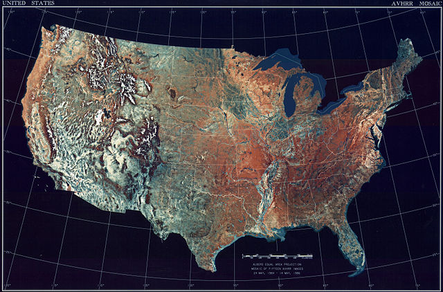
ဇမၞော် နမူနာ ဏအ် - ၈၀၀ × ၅၂၇ pixels အရာမသ္ဂုတ်သွာတ်လဝ်ဂမၠိုၚ်: ၃၂၀ × ၂၁၁ pixels | ၆၄၀ × ၄၂၂ pixels | ၁၀၂၄ × ၆၇၄ pixels | ၁၂၈၀ × ၈၄၃ pixels | ၂၅၆၀ × ၁၆၈၆ pixels | ၃၁၉၉ × ၂၁၀၇ pixels တၞဟ်။
ဝှာင် တမ်မူလ (၃၁၉၉ × ၂၁၀၇ pixels, file size: ၁၁.၁၉ MB, MIME type: image/jpeg)
သကေမ်
| ကဵုယၟု |
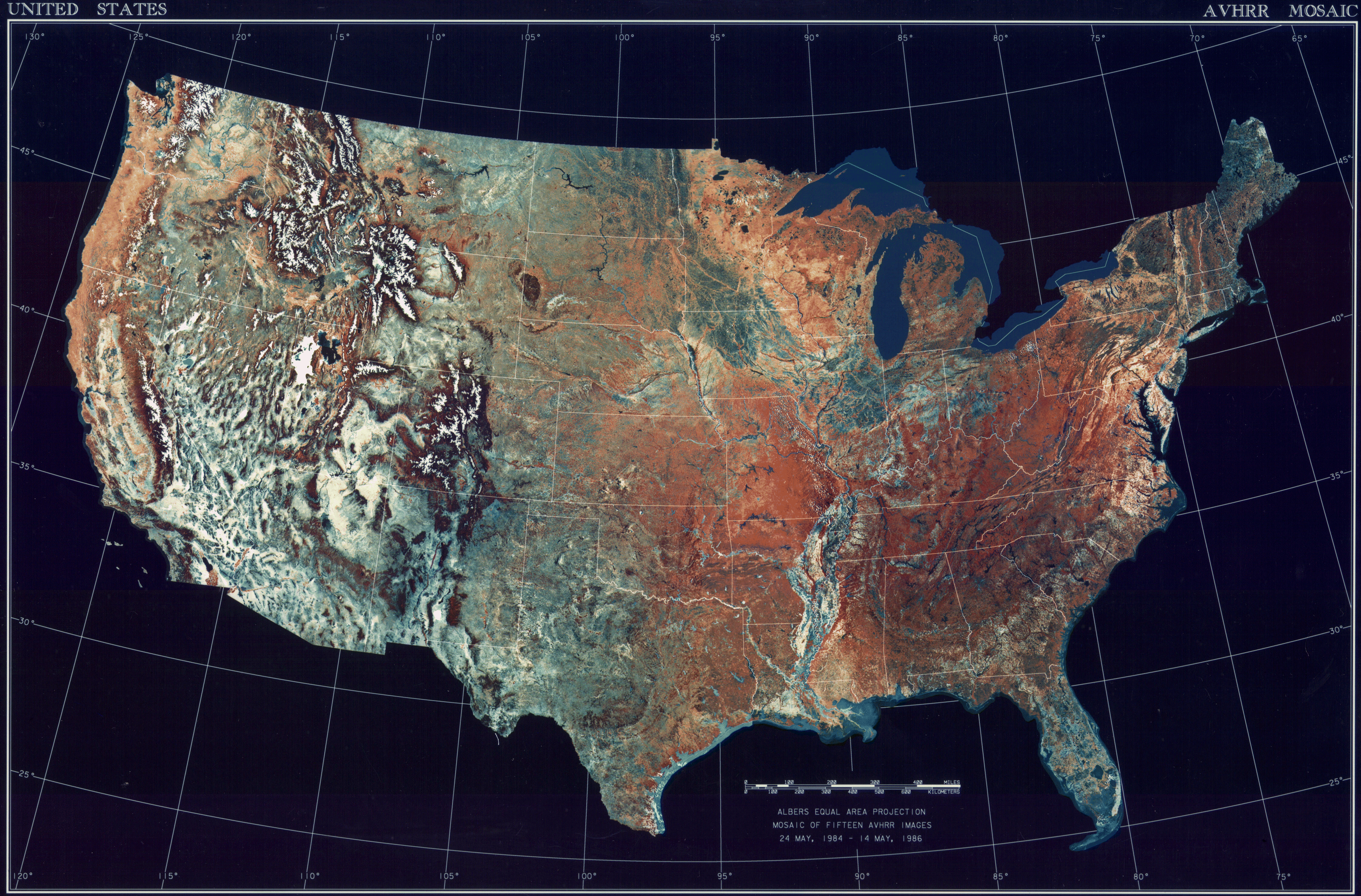
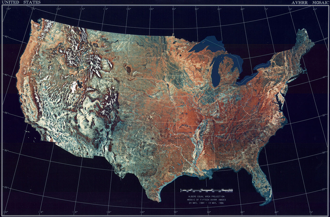
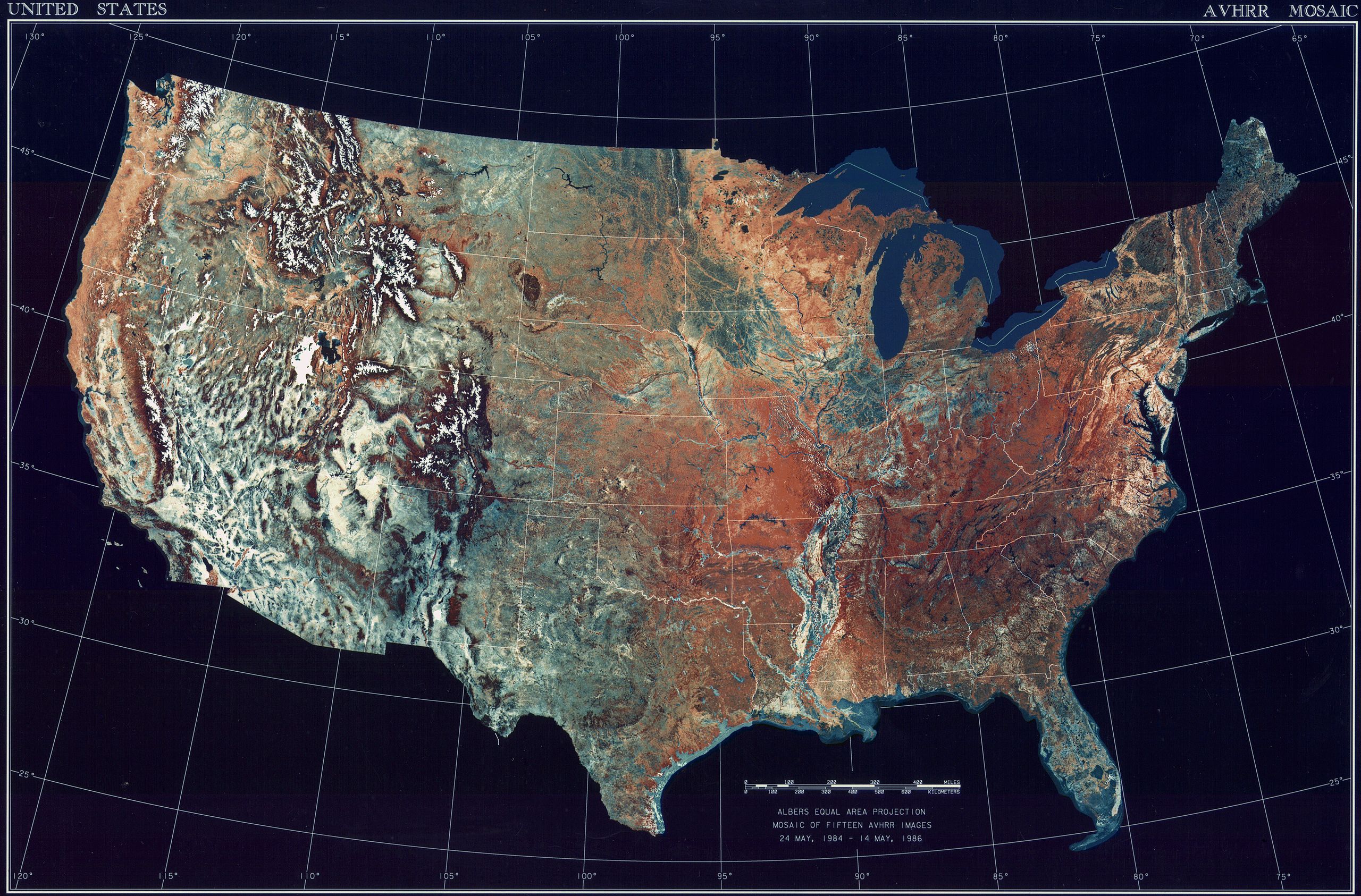
Deutsch: Satellitenbild der 48 Zentralstaaten der Vereinigten Staaten.
|
| စၟတ်တ္ၚဲ | ၂၄ မေ ၁၉၈၄ - ၁၄ မေ ၁၉၈၆ |
| တမ်ရိုဟ် | National Climactic Data Center/NOAA Satellite and Information Service |
| ကဝိ | U.S. Dept. of Commerce/National Climactic Data Center/NOAA Satellite and Information Service |
မသ္ဂုတ်သွာတ်လာင်ဇြေန်
This image is in the public domain because it contains materials that originally came from the U.S. National Oceanic and Atmospheric Administration, taken or made as part of an employee's official duties.
|
ဝှာင် လၟေင်အပြံင်အလှာဲ
ဍဵု လတူ စၟတ်တ္ၚဲ/အခိင် မွဲမွဲ သွက်ဂွံ ထ္ၜးကဵု ဝှာင် မကတဵုဒှ်လဝ် ပ္ဍဲအခိင်ဂှ်၊၊
| စၟတ်တ္ၚဲ/အခိင် | ဗီုပြင်နမူနာ | ပမာဏ | ညးလွပ် | တင်ပသောင်ကလး | |
|---|---|---|---|---|---|
| လၟုဟ် | ၁၄:၃၆၊ ၂၅ အံက်တဝ်ဗါ ၂၀၁၃ | | ၃၁၉၉ × ၂၁၀၇ (၁၁.၁၉ MB) | McZusatz | compression (uploaded using chunked upload script) |
| ၀၀:၀၃၊ ၅ မာတ် ၂၀၀၉ |  | ၃၁၉၉ × ၂၁၀၇ (၄၅၀ KB) | File Upload Bot (Magnus Manske) | {{BotMoveToCommons|en.wikipedia|year={{subst:CURRENTYEAR}}|month={{subst:CURRENTMONTHNAME}}|day={{subst:CURRENTDAY}}}} {{Information |Description={{en|Topographical map of the United States}} |Source=Transferred from [http://en.wikipedia.org en.wikipedia |
ဝှာင် ဗီုဂွံစကာ
အရာမဆက်ဗက်ကၠုင် page links ကုဝှာင်ဏအ် ဂမၠိုင်ဂှ် -
ဝှာင် သွက်ဂွံသုင်စောဲ ဂလုပ်ဗဴ
ဗွဲသၟဝ်ဏအ်ဂှ် ဒှ်အရာ ဝဳကဳတၞဟ် မစကာလဝ် ဝှာင်ဏအ်၊၊
- ဗီုစကာ ပ္ဍဲ ar.wikipedia.org
- ဗီုစကာ ပ္ဍဲ arz.wikipedia.org
- ဗီုစကာ ပ္ဍဲ ceb.wikipedia.org
- ဗီုစကာ ပ္ဍဲ de.wikipedia.org
- ဗီုစကာ ပ္ဍဲ el.wikipedia.org
- ဗီုစကာ ပ္ဍဲ en.wikipedia.org
- ဗီုစကာ ပ္ဍဲ es.wikipedia.org
- ဗီုစကာ ပ္ဍဲ fa.wikipedia.org
- ဗီုစကာ ပ္ဍဲ fr.wikipedia.org
- ဗီုစကာ ပ္ဍဲ fy.wikipedia.org
- ဗီုစကာ ပ္ဍဲ gu.wikipedia.org
- ဗီုစကာ ပ္ဍဲ he.wikipedia.org
- ဗီုစကာ ပ္ဍဲ ia.wikipedia.org
- ဗီုစကာ ပ္ဍဲ incubator.wikimedia.org
- ဗီုစကာ ပ္ဍဲ kn.wikipedia.org
- ဗီုစကာ ပ္ဍဲ la.wikipedia.org
- ဗီုစကာ ပ္ဍဲ lt.wikipedia.org
- ဗီုစကာ ပ္ဍဲ ms.wikipedia.org
- ဗီုစကာ ပ္ဍဲ my.wikipedia.org
- ဗီုစကာ ပ္ဍဲ pap.wikipedia.org
- ဗီုစကာ ပ္ဍဲ sq.wikipedia.org
- ဗီုစကာ ပ္ဍဲ sv.wikipedia.org
- ဗီုစကာ ပ္ဍဲ sw.wikipedia.org
- ဗီုစကာ ပ္ဍဲ ta.wikipedia.org
- ဗီုစကာ ပ္ဍဲ tcy.wikipedia.org
- ဗီုစကာ ပ္ဍဲ th.wikipedia.org
- ဗီုစကာ ပ္ဍဲ tl.wikipedia.org
- ဗီုစကာ ပ္ဍဲ uk.wikipedia.org
- ဗီုစကာ ပ္ဍဲ www.wikidata.org
- ဗီုစကာ ပ္ဍဲ yo.wikipedia.org