
ဝှာင်:South Korea physical map.svg

Size of this PNG preview of this SVG file: ၇၆၂ × ၆၀၀ pixels. အရာမသ္ဂုတ်သွာတ်လဝ်ဂမၠိုၚ်: ၃၀၅ × ၂၄၀ pixels | ၆၁၀ × ၄၈၀ pixels | ၉၇၆ × ၇၆၈ pixels | ၁၂၈၀ × ၁၀၀၈ pixels | ၂၅၆၀ × ၂၀၁၆ pixels | ၈၅၁ × ၆၇၀ pixels တၞဟ်။
ဝှာင် တမ်မူလ (SVG ဝှာင်, မိက်ကဵုကသပ် ၈၅၁ × ၆၇၀ pixels, ဇမၞော် ဝှာင်: ၁.၆၆ MB)
သကေမ်
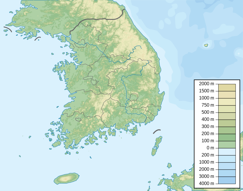
| ကဵုယၟု | Map of South Korea, parameters equivalent to File:South Korea location map.svg |
| စၟတ်တ္ၚဲ | |
| တမ်ရိုဟ် | ကမၠောန် ဇကုအပိုင် |
| ကဝိ | Urutseg |
| SVG genesis |
မသ္ဂုတ်သွာတ်လာင်ဇြေန်
ကျွန်ုပ်၊ ဤလုပ်ဆောင်ချက်၏ မူပိုင်ခွင့်ပိုင်ရှင်အနေဖြင့် ဤနေရာမှ အောက်ပါလိုင်စင်အောက်တွင် ထုတ်လွှင့်ပါသည်:
| ဤဖိုင်ကို Creative Commons CC0 1.0 Universal Public Domain Dedication အောက်တွင် ရရှိနိုင်အောင် ဆောင်ရွက်ထားပါသည်။ | |
| The person who associated a work with this deed has dedicated the work to the public domain by waiving all of their rights to the work worldwide under copyright law, including all related and neighboring rights, to the extent allowed by law. You can copy, modify, distribute and perform the work, even for commercial purposes, all without asking permission.
|
ဝှာင် လၟေင်အပြံင်အလှာဲ
ဍဵု လတူ စၟတ်တ္ၚဲ/အခိင် မွဲမွဲ သွက်ဂွံ ထ္ၜးကဵု ဝှာင် မကတဵုဒှ်လဝ် ပ္ဍဲအခိင်ဂှ်၊၊
| စၟတ်တ္ၚဲ/အခိင် | ဗီုပြင်နမူနာ | ပမာဏ | ညးလွပ် | တင်ပသောင်ကလး | |
|---|---|---|---|---|---|
| လၟုဟ် | ၁၁:၃၈၊ ၃ ဇာန်နဝါရဳ ၂၀၂၃ | | ၈၅၁ × ၆၇၀ (၁.၆၆ MB) | Antonsusi | also |
| ၁၁:၃၅၊ ၃ ဇာန်နဝါရဳ ၂၀၂၃ |  | ၈၅၁ × ၆၇၀ (၁.၆၆ MB) | Antonsusi | validizing | |
| ၂၂:၄၆၊ ၄ ဂျောန် ၂၀၁၃ |  | ၈၅၁ × ၆၇၀ (၁.၆၇ MB) | Garam | - Western Sea Military Demarcation Line | |
| ၁၀:၃၉၊ ၂၅ ဂျူလာင် ၂၀၁၁ |  | ၈၅၁ × ၆၇၀ (၁.၆၈ MB) | Urutseg | moing legend away from Dokdo(en:Liancourt Rocks) | |
| ၀၁:၀၄၊ ၁၃ မာတ် ၂၀၁၁ |  | ၈၅၁ × ၆၇၀ (၁.၆၈ MB) | Urutseg |
ဝှာင် ဗီုဂွံစကာ
အရာမဆက်ဗက်ကၠုင် 2 pages link ကုဝှာင်ဏအ် ဂမၠိုင်ဂှ် -
ဝှာင် သွက်ဂွံသုင်စောဲ ဂလုပ်ဗဴ
ဗွဲသၟဝ်ဏအ်ဂှ် ဒှ်အရာ ဝဳကဳတၞဟ် မစကာလဝ် ဝှာင်ဏအ်၊၊
- ဗီုစကာ ပ္ဍဲ arz.wikipedia.org
- ဗီုစကာ ပ္ဍဲ ast.wikipedia.org
- ဗီုစကာ ပ္ဍဲ azb.wikipedia.org
- ဗီုစကာ ပ္ဍဲ ban.wikipedia.org
- ဗီုစကာ ပ္ဍဲ ba.wikipedia.org
- ဗီုစကာ ပ္ဍဲ be.wikipedia.org
- ဗီုစကာ ပ္ဍဲ bn.wikipedia.org
- ဗီုစကာ ပ္ဍဲ ca.wikipedia.org
- ဗီုစကာ ပ္ဍဲ ceb.wikipedia.org
- ဗီုစကာ ပ္ဍဲ ce.wikipedia.org
- ဗီုစကာ ပ္ဍဲ ckb.wikipedia.org
- ဗီုစကာ ပ္ဍဲ cs.wikipedia.org
- ဗီုစကာ ပ္ဍဲ da.wikipedia.org
- ဗီုစကာ ပ္ဍဲ de.wikipedia.org
- ဗီုစကာ ပ္ဍဲ de.wikivoyage.org
ဗဵု more global usage ဝှာင်ဏအ်၊၊