ဝှာင်:Africa map 1939, colours.svg

Size of this PNG preview of this SVG file: ၆၃၅ × ၅၉၉ pixels. အရာမသ္ဂုတ်သွာတ်လဝ်ဂမၠိုၚ်: ၂၅၄ × ၂၄၀ pixels | ၅၀၈ × ၄၈၀ pixels | ၈၁၄ × ၇၆၈ pixels | ၁၀၈၅ × ၁၀၂၄ pixels | ၂၁၆၉ × ၂၀၄၈ pixels | ၁၄၃၀ × ၁၃၅၀ pixels တၞဟ်။
ဝှာင် တမ်မူလ (SVG ဝှာင်, မိက်ကဵုကသပ် ၁၄၃၀ × ၁၃၅၀ pixels, ဇမၞော် ဝှာင်: ၁.၈၁ MB)
ဝှာင် လၟေင်အပြံင်အလှာဲ
ဍဵု လတူ စၟတ်တ္ၚဲ/အခိင် မွဲမွဲ သွက်ဂွံ ထ္ၜးကဵု ဝှာင် မကတဵုဒှ်လဝ် ပ္ဍဲအခိင်ဂှ်၊၊
| စၟတ်တ္ၚဲ/အခိင် | ဗီုပြင်နမူနာ | ပမာဏ | ညးလွပ် | တင်ပသောင်ကလး | |
|---|---|---|---|---|---|
| လၟုဟ် | ၂၀:၅၃၊ ၁၆ ဒဳဇြေမ်ဗါ ၂၀၂၃ |  | ၁၄၃၀ × ၁၃၅၀ (၁.၈၁ MB) | Hogweard | Minor font issue |
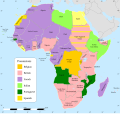
| ၀၅:၂၆၊ ၁၅ ဒဳဇြေမ်ဗါ ၂၀၂၃ |  | ၁၄၃၀ × ၁၃၅၀ (၁.၈၁ MB) | Hogweard | {{Information |Description=A map of Africa in 1939, with colours for the sovereign powers |Source={{f|Africa map 1935, colours 2.svg}} |Date=2023-12-14 |Author={{u|Hogweard}} |Permission={{PD-self}} |other_versions= }} Category:SVG maps showing history of Africa Category:Maps of 20th-century Africa}} |
ဝှာင် ဗီုဂွံစကာ
မုက်လိက် မရပ်စပ် ဝှာင်ဏအ် ဟွံမဲ၊၊
ဝှာင် သွက်ဂွံသုင်စောဲ ဂလုပ်ဗဴ
ဗွဲသၟဝ်ဏအ်ဂှ် ဒှ်အရာ ဝဳကဳတၞဟ် မစကာလဝ် ဝှာင်ဏအ်၊၊
- ဗီုစကာ ပ္ဍဲ en.wikipedia.org
