
ဝှာင်:Austria relief location map.jpg

ဇမၞော် နမူနာ ဏအ် - ၈၀၀ × ၄၄၆ pixels အရာမသ္ဂုတ်သွာတ်လဝ်ဂမၠိုၚ်: ၃၂၀ × ၁၇၈ pixels | ၆၄၀ × ၃၅၇ pixels | ၁၂၅၆ × ၇၀၀ pixels တၞဟ်။
ဝှာင် တမ်မူလ (၁၂၅၆ × ၇၀၀ pixels, file size: ၆၇၇ KB, MIME type: image/jpeg)
သကေမ်
| ကဵုယၟု |
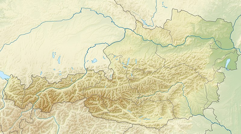
English: Location map of Austria
Equirectangular projection, N/S stretching 150 %. Geographic limits of the map:
|
| စၟတ်တ္ၚဲ | |
| တမ်ရိုဟ် | ကမၠောန် ဇကုအပိုင် |
| ကဝိ | Uwe Dedering |
| အခြား ဗားရှင်းများ |
Derivative works of this file: ÖRF 2011.png
|

မသ္ဂုတ်သွာတ်လာင်ဇြေန်
ကျွန်ုပ်၊ ဤလုပ်ဆောင်ချက်၏ မူပိုင်ခွင့်ပိုင်ရှင်အနေဖြင့် ဤနေရာမှ အောက်ပါလိုင်စင်များအောက်တွင် ထုတ်လွှင့်ပါသည်:
ဝှာင်ဏအ်ဂှ် စၟတ်သမ္တီလဝ် နကဵုလာင်ဇြေန် Creative Commons Attribution-Share Alike 3.0 Unported ရ၊၊
- မၞးဂှ် ဗွဲမဗၠးၜး -
- သွက်ဂွံ ပါ်ပရအ် – သွက်ဂွံ စၠောအ်ပပ်ပဳ၊ တြးပတိတ်၊ ဗလး ကမၠောန်
- သွက်ဂွံ ပကောံနှဴ – သွက်ဂွံ ပလေဝ်ပညဳ ကမၠောန်
- နကဵု တင်မသ္ဒးဒ္ဂေတ်ဗက် ဗွဲသၟဝ်ဏအ်ဂှ်
- တင်မစှ်ေစိုတ် – မၞး သ္ဒးဒ္ဂေတ်ဗက် သၞောတ်ဝ် မဖျေဟ်လဝ် စပ်ကဵု အစာချူလိက် ဟွံသေင်မ္ဂး တၠမူတအ်ရောင်၊၊ (ဆဂး နကဵုနဲလဵု အကာဲအရာ ဗီုလဵုလေဝ် ဟွံကဵုကသပ် ဟွံထံက်ဂလာန် ကုမၞး ပ္ဍဲအရာမစကာ ဒြပ်ညးတၞဟ်တအ်ရောင်)။
- ပါ်ပရအ် အရာမတုပ်သၟဟ် – ယဝ်ရ မၞး ပလေဝ်၊ ပြံင်လှာဲ ဟွံသေင်မ္ဂး ထပ်ခၞံဗဒှ်တၟိမ္ဂး အရာကမၠောန်တအ် သီုဖအိုတ်ဂှ် သ္ဒးပရးပတိတ် နကဵုသၟဝ် မတုပ် ဟွံသေင်မ္ဂး မသၟဟ် ကုလာင်ဇြေန် ကမၠောန်တြေံဂှ် ဟေင်ရ၊၊

|
လိက်တအ်ဂှ် သၠးကဵုလဝ် အခေါင် သွက်ဂွံ စၠောအ်ကပ်ပဳ၊ ပရး ကီု သီုကဵု ပလေဝ်ပခိုဟ်ပတိုန် အတိုင်သၞောတ်ဝ် GNU Free Documentation License, တုဲ မူ ၁.၂ ဟွံသေင်မ္ဂး မူတြေံနူဂှ် မတြးပတိတ် နကဵု သၞောတ်ဝ်လာင်ဇြေန် Free Software Foundation; with no Invariant Sections, no Front-Cover Texts, and no Back-Cover Texts. A copy of the license is included in the section entitled GNU Free Documentation License. |
လာင်ဇြေန် မၞး မၞုံပၟိက်ဂှ် မၞးရုဲစှ်ကေတ် မာန်ရ၊၊

|
This map image could be re-created using vector graphics as an SVG file. This has several advantages; see Commons:Media for cleanup for more information. If an SVG form of this image is available, please upload it and afterwards replace this template with
{{vector version available|new image name}}.
It is recommended to name the SVG file “Austria relief location map.svg”—then the template Vector version available (or Vva) does not need the new image name parameter. |


ဝှာင် လၟေင်အပြံင်အလှာဲ
ဍဵု လတူ စၟတ်တ္ၚဲ/အခိင် မွဲမွဲ သွက်ဂွံ ထ္ၜးကဵု ဝှာင် မကတဵုဒှ်လဝ် ပ္ဍဲအခိင်ဂှ်၊၊
| စၟတ်တ္ၚဲ/အခိင် | ဗီုပြင်နမူနာ | ပမာဏ | ညးလွပ် | တင်ပသောင်ကလး | |
|---|---|---|---|---|---|
| လၟုဟ် | ၁၅:၄၄၊ ၂၈ ဂျောန် ၂၀၁၀ | | ၁၂၅၆ × ၇၀၀ (၆၇၇ KB) | Uwe Dedering | very little border change |
| ၁၈:၅၄၊ ၂၆ ဨပြဳ ၂၀၁၀ |  | ၁၂၅၆ × ၇၀၀ (၆၇၇ KB) | Uwe Dedering | rhine | |
| ၁၉:၂၄၊ ၂၄ ဨပြဳ ၂၀၁၀ |  | ၁၂၅၆ × ၇၀၀ (၆၇၆ KB) | Uwe Dedering | {{Information |Description={{en|1=Location map of Austria}} Equirectangular projection, N/S stretching 150 %. Geographic limits of the map: * N: 49.2° N * S: 46.3° N * W: 9.4° E * E: 17.2° E Made with Natural Earth. Free |
ဝှာင် ဗီုဂွံစကာ
မုက်လိက် မရပ်စပ် ဝှာင်ဏအ် ဟွံမဲ၊၊
ဝှာင် သွက်ဂွံသုင်စောဲ ဂလုပ်ဗဴ
ဗွဲသၟဝ်ဏအ်ဂှ် ဒှ်အရာ ဝဳကဳတၞဟ် မစကာလဝ် ဝှာင်ဏအ်၊၊
- ဗီုစကာ ပ္ဍဲ ab.wikipedia.org
- ဗီုစကာ ပ္ဍဲ als.wikipedia.org
- ဗီုစကာ ပ္ဍဲ am.wikipedia.org
- ဗီုစကာ ပ္ဍဲ an.wikipedia.org
- ဗီုစကာ ပ္ဍဲ ar.wikipedia.org
- ဗီုစကာ ပ္ဍဲ arz.wikipedia.org
- ဗီုစကာ ပ္ဍဲ ast.wikipedia.org
- ဗီုစကာ ပ္ဍဲ as.wikipedia.org
- ဗီုစကာ ပ္ဍဲ azb.wikipedia.org
- ဗီုစကာ ပ္ဍဲ az.wikipedia.org
- ဗီုစကာ ပ္ဍဲ ban.wikipedia.org
- ဗီုစကာ ပ္ဍဲ ba.wikipedia.org
- ဗီုစကာ ပ္ဍဲ be-tarask.wikipedia.org
- ဗီုစကာ ပ္ဍဲ be.wikipedia.org
- ဗီုစကာ ပ္ဍဲ bh.wikipedia.org
- ဗီုစကာ ပ္ဍဲ bn.wikipedia.org
ဗဵု more global usage ဝှာင်ဏအ်၊၊