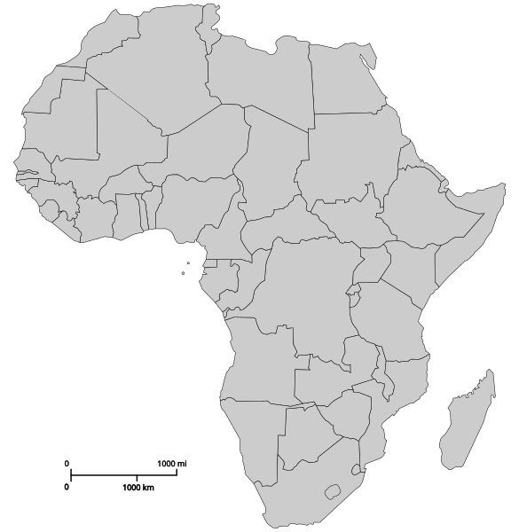
ဝှာင်:Blank Map-Africa.svg

Size of this PNG preview of this SVG file: ၅၈၅ × ၆၀၀ pixels. အရာမသ္ဂုတ်သွာတ်လဝ်ဂမၠိုၚ်: ၂၃၄ × ၂၄၀ pixels | ၄၆၈ × ၄၈၀ pixels | ၇၄၉ × ၇၆၈ pixels | ၉၉၉ × ၁၀၂၄ pixels | ၁၉၉၈ × ၂၀၄၈ pixels | ၁၂၀၀ × ၁၂၃၀ pixels တၞဟ်။
ဝှာင် တမ်မူလ (SVG ဝှာင်, မိက်ကဵုကသပ် ၁၂၀၀ × ၁၂၃၀ pixels, ဇမၞော် ဝှာင်: ၅၄ KB)
ဝှာင် လၟေင်အပြံင်အလှာဲ
ဍဵု လတူ စၟတ်တ္ၚဲ/အခိင် မွဲမွဲ သွက်ဂွံ ထ္ၜးကဵု ဝှာင် မကတဵုဒှ်လဝ် ပ္ဍဲအခိင်ဂှ်၊၊
| စၟတ်တ္ၚဲ/အခိင် | ဗီုပြင်နမူနာ | ပမာဏ | ညးလွပ် | တင်ပသောင်ကလး | |
|---|---|---|---|---|---|
| လၟုဟ် | ၀၅:၂၂၊ ၉ မာတ် ၂၀၁၈ |  | ၁၂၀၀ × ၁၂၃၀ (၅၄ KB) | Maphobbyist | Reverted to version as of 14:58, 20 October 2011 (UTC) |
| ၀၆:၄၅၊ ၁၈ ဂျူလာင် ၂၀၁၇ |  | ၁၂၀၀ × ၁၂၃၀ (၆၃ KB) | AVRTM2 | Reverted to version as of 08:33, 20 January 2017 (UTC) | |
| ၂၃:၁၅၊ ၁၃ ဂျူလာင် ၂၀၁၇ |  | ၁၂၀၀ × ၁၂၃၀ (၅၉ KB) | Mosahih | Minor modification | |
| ၂၂:၂၀၊ ၁၃ ဂျူလာင် ၂၀၁၇ |  | ၁၂၀၀ × ၁၂၃၀ (၅၄ KB) | Mosahih | SADR unrecognized country | |
| ၁၅:၀၃၊ ၂၀ ဇာန်နဝါရဳ ၂၀၁၇ |  | ၁၂၀၀ × ၁၂၃၀ (၆၃ KB) | عادل | correction of Egypt borders | |
| ၂၁:၂၈၊ ၂၀ အံက်တဝ်ဗါ ၂၀၁၁ |  | ၁၂၀၀ × ၁၂၃၀ (၅၄ KB) | Ninjatacoshell | Changed Sudan from a single object with a line across it to two objects—north and south. | |
| ၀၁:၄၇၊ ၂၃ ဂျူလာင် ၂၀၁၁ |  | ၁၂၀၀ × ၁၂၃၀ (၄၇ KB) | Liandrei | +South Sudan | |
| ၀၆:၂၈၊ ၁၉ မာတ် ၂၀၀၇ |  | ၁၂၀၀ × ၁၂၃၀ (၆၇ KB) | Revolus | Lesotho nach hinten, Quelle de:Bild:Afrika_Politisch_2.png | |
| ၀၆:၁၄၊ ၁၉ မာတ် ၂၀၀၇ |  | ၁၂၀၀ × ၁၂၃၀ (၆၇ KB) | Revolus | Angepasst; kleiner; ordentliche IDs; leider deutsch, da zu faul, englische Namen rauszusuchen | |
| ၁၀:၂၆၊ ၇ သေပ်တေမ်ဗါ ၂၀၀၆ |  | ၁၂၀၀ × ၁၂၃၀ (၈၅ KB) | Andreas 06 | Imagesize reduced |
ဝှာင် ဗီုဂွံစကာ
မုက်လိက် မရပ်စပ် ဝှာင်ဏအ် ဟွံမဲ၊၊
ဝှာင် သွက်ဂွံသုင်စောဲ ဂလုပ်ဗဴ
ဗွဲသၟဝ်ဏအ်ဂှ် ဒှ်အရာ ဝဳကဳတၞဟ် မစကာလဝ် ဝှာင်ဏအ်၊၊
- ဗီုစကာ ပ္ဍဲ ar.wikipedia.org
- ဗီုစကာ ပ္ဍဲ azb.wikipedia.org
- ဗီုစကာ ပ္ဍဲ bg.wikipedia.org
- ဗီုစကာ ပ္ဍဲ dag.wikipedia.org
- ဗီုစကာ ပ္ဍဲ de.wikipedia.org
- ဗီုစကာ ပ္ဍဲ en.wikipedia.org
- List of temples of the Church of Jesus Christ of Latter-day Saints
- Johannesburg South Africa Temple
- Aba Nigeria Temple
- Africa
- Accra Ghana Temple
- User:Lumber Jack second account
- List of temples of the Church of Jesus Christ of Latter-day Saints by geographic region
- Comparison of temples of the Church of Jesus Christ of Latter-day Saints
- Template:Africa Labelled Map
- Temple architecture (LDS Church)
- Billy Johnson (Mormon)
- Membership statistics of the Church of Jesus Christ of Latter-day Saints
- Membership statistics of the Church of Jesus Christ of Latter-day Saints (United States)
- Membership statistics of the Church of Jesus Christ of Latter-day Saints (Canada)
- The Church of Jesus Christ of Latter-day Saints in Ghana
- Temple (LDS Church)
- Template:LDS-Africa
- The Church of Jesus Christ of Latter-day Saints in the Democratic Republic of the Congo
- The Church of Jesus Christ of Latter-day Saints in Liberia
- Durban South Africa Temple
- The Church of Jesus Christ of Latter-day Saints in South Africa
- The Church of Jesus Christ of Latter-day Saints in Nigeria
- The Church of Jesus Christ of Latter-day Saints in Sierra Leone
- The Church of Jesus Christ of Latter-day Saints in Angola
- The Church of Jesus Christ of Latter-day Saints in Botswana
- The Church of Jesus Christ of Latter-day Saints in Zimbabwe
- The Church of Jesus Christ of Latter-day Saints in Uganda
- The Church of Jesus Christ of Latter-day Saints in Kenya
- The Church of Jesus Christ of Latter-day Saints in Ivory Coast
- The Church of Jesus Christ of Latter-day Saints in Cape Verde
- The Church of Jesus Christ of Latter-day Saints in Madagascar
- User:Northamerica1000/Notepad
- User:Pharaoh Amun
- Abidjan Ivory Coast Temple
- Outline of the Church of Jesus Christ of Latter-day Saints
- Harare Zimbabwe Temple
- Talk:2018 Équateur province Ebola outbreak/Archive 1
- Kinshasa Democratic Republic of the Congo Temple
- Praia Cape Verde Temple
- Bengaluru India Temple
- Template:LDS-World
- User:Mujinga/DraftT28
ဗဵု more global usage ဝှာင်ဏအ်၊၊
