ဝှာင်:China Fujian2 location map.svg

အခြားဘာသာစကားများဖြင့် စာမျက်နှာအကြောင်းအရာများကို ပံ့ပိုးမထားပါ။
နူ ဝဳကဳပဳဒဳယာ

ဝှာင် တမ်မူလ(SVG ဝှာင်, မိက်ကဵုကသပ် ၇၈၀ × ၈၁၈ pixels, ဇမၞော် ဝှာင်: ၂၇၇ KB)

ဝှာင်ဏအ် ဒှ်ဝှာင် နူကဵု ဝီကီမီဒီယာ ကွန်မွန်းစ် တုဲ မဒှ်ဝှာင် မသုင်စောဲလဝ် နကဵုပရဝ်ဂျေတ် တၞဟ်လေဝ် ဒှ်မာန်ရ၊၊ အရာမလဴထ္ၜး ပ္ဍဲဝှာင်တအ်ဂှ် မုက်လိက် မလဴထ္ၜး ဝှာင် ထ္ၜးကဵုလဝ် အတိုင်ဗွဲသၟဝ်ဝွံရ၊၊

သကေမ်

ကဵုယၟု
Deutsch: Positionskarte von Fujian, Volksrepublik China

Quadratische Plattkarte, N-S-Streckung 111 %. Geographische Begrenzung der Karte:

  • N: 28.5° N
  • S: 23.3° N
  • W: 115.5° O
  • O: 121.0° O
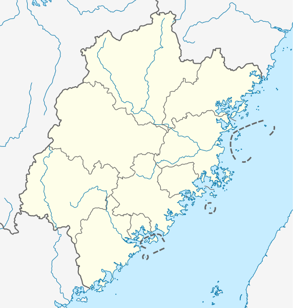
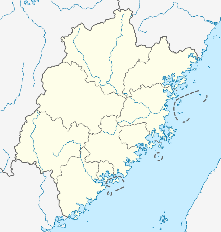
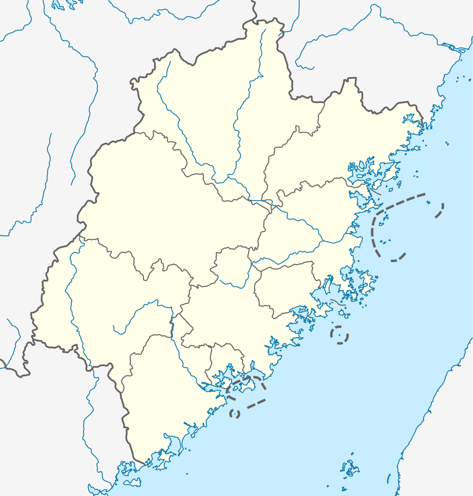
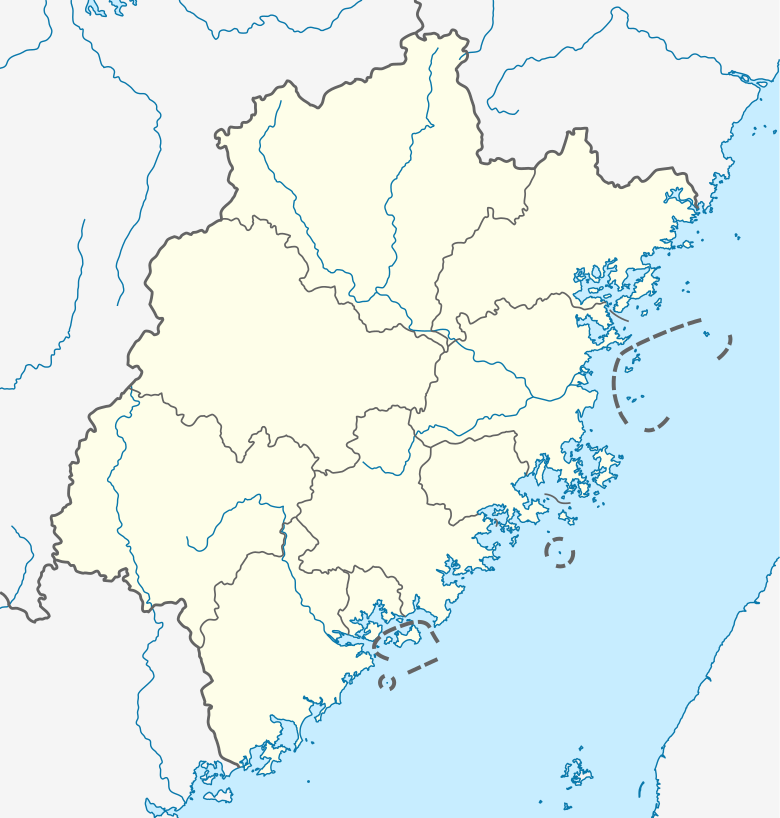
English: Location map of Fujian, People's Republic of China
(Note: the insular counties of Kinmen (Quemoy) and Lienchiang (Matsu Islands), Taiwan (ROC), are shown with dashed lines.)

Equirectangular projection, N/S stretching 111 %. Geographic limits of the map:

  • N: 28.5° N
  • S: 23.3° N
  • W: 115.5° E
  • E: 121.0° E
စၟတ်တ္ၚဲ
တမ်ရိုဟ်

ကမၠောန် ဇကုအပိုင်, using

ကဝိ NordNordWest
တင်မကဵုအခေါင်
(ကလေင်သုင်စောဲ ဝှာင်ဏအ်)

I have published this file as author NordNordWest under the "CC-BY-SA-3.0-DE" in Wikipedia. This means that free, commercial usage outside of Wikipedia is permitted under the following licence terms:

Please send me a specimen copy or the URL of the website where the file is used.

Please write an email to nnwest[at]web.de if you

  • need my postal address for sending a specimen copy
  • have further questions about the terms of the licence

PS: In case of refusal of the above terms the author reserves the right to take legal action.

w:my:Creative Commons
တင်မစှ်ေစိုတ် ပါ်ပရအ် အရာမတုပ်သၟဟ်
ဤဖိုင်သည် Creative Commons Attribution-Share Alike 3.0 ဂျာမနီ လိုင်စင်အောက်တွင် လိုင်စင်သတ်မှတ်ထားပါသည်။
မၞးဂှ် ဗွဲမဗၠးၜး -
  • သွက်ဂွံ ပါ်ပရအ် – သွက်ဂွံ စၠောအ်ပပ်ပဳ၊ တြးပတိတ်၊ ဗလး ကမၠောန်
  • သွက်ဂွံ ပကောံနှဴ – သွက်ဂွံ ပလေဝ်ပညဳ ကမၠောန်
နကဵု တင်မသ္ဒးဒ္ဂေတ်ဗက် ဗွဲသၟဝ်ဏအ်ဂှ်
  • တင်မစှ်ေစိုတ် – မၞး သ္ဒးဒ္ဂေတ်ဗက် သၞောတ်ဝ် မဖျေဟ်လဝ် စပ်ကဵု အစာချူလိက် ဟွံသေင်မ္ဂး တၠမူတအ်ရောင်၊၊ (ဆဂး နကဵုနဲလဵု အကာဲအရာ ဗီုလဵုလေဝ် ဟွံကဵုကသပ် ဟွံထံက်ဂလာန် ကုမၞး ပ္ဍဲအရာမစကာ ဒြပ်ညးတၞဟ်တအ်ရောင်)။
  • ပါ်ပရအ် အရာမတုပ်သၟဟ် – ယဝ်ရ မၞး ပလေဝ်၊ ပြံင်လှာဲ ဟွံသေင်မ္ဂး ထပ်ခၞံဗဒှ်တၟိမ္ဂး အရာကမၠောန်တအ် သီုဖအိုတ်ဂှ် သ္ဒးပရးပတိတ် နကဵုသၟဝ် မတုပ် ဟွံသေင်မ္ဂး မသၟဟ် ကုလာင်ဇြေန် ကမၠောန်တြေံဂှ် ဟေင်ရ၊၊
w:my:Creative Commons
တင်မစှ်ေစိုတ် ပါ်ပရအ် အရာမတုပ်သၟဟ်
ဝှာင်ဏအ်ဂှ် စၟတ်သမ္တီလဝ် နကဵုလာင်ဇြေန် Creative Commons Attribution-Share Alike 3.0 Unported ရ၊၊
မၞးဂှ် ဗွဲမဗၠးၜး -
  • သွက်ဂွံ ပါ်ပရအ် – သွက်ဂွံ စၠောအ်ပပ်ပဳ၊ တြးပတိတ်၊ ဗလး ကမၠောန်
  • သွက်ဂွံ ပကောံနှဴ – သွက်ဂွံ ပလေဝ်ပညဳ ကမၠောန်
နကဵု တင်မသ္ဒးဒ္ဂေတ်ဗက် ဗွဲသၟဝ်ဏအ်ဂှ်
  • တင်မစှ်ေစိုတ် – မၞး သ္ဒးဒ္ဂေတ်ဗက် သၞောတ်ဝ် မဖျေဟ်လဝ် စပ်ကဵု အစာချူလိက် ဟွံသေင်မ္ဂး တၠမူတအ်ရောင်၊၊ (ဆဂး နကဵုနဲလဵု အကာဲအရာ ဗီုလဵုလေဝ် ဟွံကဵုကသပ် ဟွံထံက်ဂလာန် ကုမၞး ပ္ဍဲအရာမစကာ ဒြပ်ညးတၞဟ်တအ်ရောင်)။
  • ပါ်ပရအ် အရာမတုပ်သၟဟ် – ယဝ်ရ မၞး ပလေဝ်၊ ပြံင်လှာဲ ဟွံသေင်မ္ဂး ထပ်ခၞံဗဒှ်တၟိမ္ဂး အရာကမၠောန်တအ် သီုဖအိုတ်ဂှ် သ္ဒးပရးပတိတ် နကဵုသၟဝ် မတုပ် ဟွံသေင်မ္ဂး မသၟဟ် ကုလာင်ဇြေန် ကမၠောန်တြေံဂှ် ဟေင်ရ၊၊
Kartenwerkstatt
This map has been made or improved in the German Kartenwerkstatt (Map Lab). You can propose maps to improve as well.

ပုံစာများ

ဤဖိုင်၏ဆိုလိုရင်းကို စာတစ်ကြောင်းရှင်းလင်းချက်ဖြင့် ထည့်သွင်းရန်

Items portrayed in this file

depicts အင်္ဂလိက်

some value

author name string အင်္ဂလိက်: NordNordWest
Wikimedia username အင်္ဂလိက်: NordNordWest

၂၀ ဂျောန် 2011

media type အင်္ဂလိက်

image/svg+xml

checksum အင်္ဂလိက်

e596af2b9c2a0648e2a815b92b71a7acc5beba40

determination method အင်္ဂလိက်: SHA-1 အင်္ဂလိက်

data size အင်္ဂလိက်

၂၈၃၃၂၂ ဘိုက်

height အင်္ဂလိက်

၈၁၈ pixel

width အင်္ဂလိက်

၇၈၀ pixel

ဝှာင် လၟေင်အပြံင်အလှာဲ

ဍဵု လတူ စၟတ်တ္ၚဲ/အခိင် မွဲမွဲ သွက်ဂွံ ထ္ၜးကဵု ဝှာင် မကတဵုဒှ်လဝ် ပ္ဍဲအခိင်ဂှ်၊၊

စၟတ်တ္ၚဲ/အခိင်ဗီုပြင်နမူနာပမာဏညးလွပ်တင်ပသောင်ကလး
လၟုဟ် ၂၃:၅၁၊ ၁၄ အံက်တဝ်ဗါ ၂၀၂၀ဍဵုသၞေမ်ၝောအ်တဲ သွက်မူလိက် နကဵု  ၂၃:၅၁၊ ၁၄ အံက်တဝ်ဗါ ၂၀၂၀၇၈၀ × ၈၁၈ (၂၇၇ KB)NordNordWestupd
၁၈:၄၈၊ ၂၀ ဂျောန် ၂၀၁၁ဍဵုသၞေမ်ၝောအ်တဲ သွက်မူလိက် နကဵု  ၁၈:၄၈၊ ၂၀ ဂျောန် ၂၀၁၁၇၈၀ × ၈၁၈ (၂၈၂ KB)NordNordWest=={{int:filedesc}}== {{Information |Description= {{de|Positionskarte von Fujian, Volksrepublik China}} Quadratische Plattkarte, N-S-Streckung 111 %. Geographische Begrenzung der Karte: * N: 28.5° N * S: 23.3° N

မုက်လိက် မရပ်စပ် ဝှာင်ဏအ် ဟွံမဲ၊၊

ဝှာင် သွက်ဂွံသုင်စောဲ ဂလုပ်ဗဴ

ဗွဲသၟဝ်ဏအ်ဂှ် ဒှ်အရာ ဝဳကဳတၞဟ် မစကာလဝ် ဝှာင်ဏအ်၊၊

ဗဵု more global usage ဝှာင်ဏအ်၊၊

မဳတာဒေတာ

ကလေၚ်သီကေတ်လဝ် နူ "https://mnw.wikipedia.org/wiki/ဝှာင်:China_Fujian2_location_map.svg"