
ဝှာင်:Han Dynasty map 2CE.png
resolution ခိုဟ် နူဏအ် ဟွံဂွံဆဵုရ၊၊
Han_Dynasty_map_2CE.png (၅၅၀ × ၃၈၂ pixels, file size: ၄၀ KB, MIME type: image/png)
သကေမ်
| ကဵုယၟု |
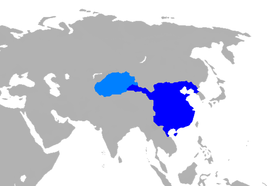
English: Map of Han Dynasty in 2 CE.
|
||
| စၟတ်တ္ၚဲ | |||
| တမ်ရိုဟ် |
Own work using:
|
||
| ကဝိ | User:Historian of the arab people | ||
| အခြား ဗားရှင်းများ |
|

မသ္ဂုတ်သွာတ်လာင်ဇြေန်
| I, the copyright holder of this work, release this work into the public domain. This applies worldwide. In some countries this may not be legally possible; if so: အကျွန်ုပ်သည် ဤဖန်တီးမှုလက်ရာကို ဥပဒေအရလိုအပ်ခြင်းမရှိသည့် မည်သည့်အခြေအနေမျိုးတွက်မဆို၊ မည်သို့သော ရည်ရွယ်ချက်အတွက်မဆို ၎င်းကို မည်သူမဆို အသုံးပြုပိုင်ခွင့်အား ပေးအပ်သည်။ |
ဝှာင် လၟေင်အပြံင်အလှာဲ
ဍဵု လတူ စၟတ်တ္ၚဲ/အခိင် မွဲမွဲ သွက်ဂွံ ထ္ၜးကဵု ဝှာင် မကတဵုဒှ်လဝ် ပ္ဍဲအခိင်ဂှ်၊၊
| စၟတ်တ္ၚဲ/အခိင် | ဗီုပြင်နမူနာ | ပမာဏ | ညးလွပ် | တင်ပသောင်ကလး | |
|---|---|---|---|---|---|
| လၟုဟ် | ၁၂:၂၁၊ ၆ ဇာန်နဝါရဳ ၂၀၁၉ | | ၅၅၀ × ၃၈၂ (၄၀ KB) | 复旦大学张超 | add Hainan |
| ၁၀:၅၉၊ ၆ ဇာန်နဝါရဳ ၂၀၁၉ |  | ၅၁၁ × ၃၈၂ (၃၉ KB) | 复旦大学张超 | edit | |
| ၁၀:၅၀၊ ၆ ဇာန်နဝါရဳ ၂၀၁၉ |  | ၅၅၀ × ၃၈၂ (၄၀ KB) | 复旦大学张超 | User created page with UploadWizard |
ဝှာင် ဗီုဂွံစကာ
မုက်လိက် မရပ်စပ် ဝှာင်ဏအ် ဟွံမဲ၊၊
ဝှာင် သွက်ဂွံသုင်စောဲ ဂလုပ်ဗဴ
ဗွဲသၟဝ်ဏအ်ဂှ် ဒှ်အရာ ဝဳကဳတၞဟ် မစကာလဝ် ဝှာင်ဏအ်၊၊
- ဗီုစကာ ပ္ဍဲ bat-smg.wikipedia.org
- ဗီုစကာ ပ္ဍဲ cs.wikipedia.org
- ဗီုစကာ ပ္ဍဲ cv.wikipedia.org
- ဗီုစကာ ပ္ဍဲ en.wikipedia.org
- ဗီုစကာ ပ္ဍဲ es.wikipedia.org
- ဗီုစကာ ပ္ဍဲ fa.wikipedia.org
- ဗီုစကာ ပ္ဍဲ fr.wikipedia.org
- ဗီုစကာ ပ္ဍဲ gn.wikipedia.org
- ဗီုစကာ ပ္ဍဲ id.wikipedia.org
- ဗီုစကာ ပ္ဍဲ ja.wikipedia.org
- ဗီုစကာ ပ္ဍဲ ko.wikipedia.org
- ဗီုစကာ ပ္ဍဲ lld.wikipedia.org
- ဗီုစကာ ပ္ဍဲ mn.wikipedia.org
- ဗီုစကာ ပ္ဍဲ ms.wikipedia.org
- ဗီုစကာ ပ္ဍဲ mt.wikipedia.org
- ဗီုစကာ ပ္ဍဲ nds.wikipedia.org
- ဗီုစကာ ပ္ဍဲ pnb.wikipedia.org
- ဗီုစကာ ပ္ဍဲ ru.wikipedia.org
- ဗီုစကာ ပ္ဍဲ si.wikipedia.org
- ဗီုစကာ ပ္ဍဲ sl.wikipedia.org
- ဗီုစကာ ပ္ဍဲ sq.wikipedia.org
- ဗီုစကာ ပ္ဍဲ sr.wikipedia.org
- ဗီုစကာ ပ္ဍဲ th.wikipedia.org
- ဗီုစကာ ပ္ဍဲ tr.wikipedia.org
- ဗီုစကာ ပ္ဍဲ ur.wikipedia.org
- ဗီုစကာ ပ္ဍဲ vi.wikipedia.org