
ဝှာင်:Holy Trinity church Street.jpg
ဇမၞော် နမူနာ ဏအ် - ၄၅၀ × ၆၀၀ pixels အရာမသ္ဂုတ်သွာတ်လဝ်ဂမၠိုၚ်: ၁၈၀ × ၂၄၀ pixels | ၄၈၀ × ၆၄၀ pixels တၞဟ်။
ဝှာင် တမ်မူလ (၄၈၀ × ၆၄၀ pixels, file size: ၇၀ KB, MIME type: image/jpeg)
သကေမ်
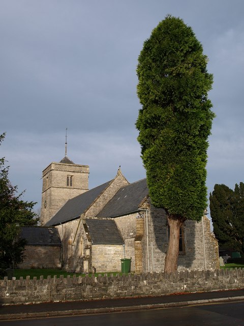
This is a photo of listed building number 1058753. |
| ကဵုယၟု | Holy Trinity church, Street |
| စၟတ်တ္ၚဲ | |
| တမ်ရိုဟ် | From geograph.org.uk |
| ကဝိ | Derek Harper |
| တင်မကဵုအခေါင် (ကလေင်သုင်စောဲ ဝှာင်ဏအ်) |
Creative Commons Attribution Share-alike license 2.0 |
| ဒဒှ်မစၟတ်သမ္တီကေတ် (required by the license) | Derek Harper / Holy Trinity church, Street / |
| Camera location | | View this and other nearby images on: OpenStreetMap |
|---|
မသ္ဂုတ်သွာတ်လာင်ဇြေန်

|
This image was taken from the Geograph project collection. See this photograph's page on the Geograph website for the photographer's contact details. The copyright on this image is owned by Derek Harper and is licensed for reuse under the Creative Commons Attribution-ShareAlike 2.0 license.
|
ဤဖိုင်သည် Creative Commons Attribution-Share Alike 2.0 Generic လိုင်စင်အောက်တွင် လိုင်စင်သတ်မှတ်ထားပါသည်။
ဒဒှ်မစၟတ်သမ္တီကေတ်: Derek Harper
- မၞးဂှ် ဗွဲမဗၠးၜး -
- သွက်ဂွံ ပါ်ပရအ် – သွက်ဂွံ စၠောအ်ပပ်ပဳ၊ တြးပတိတ်၊ ဗလး ကမၠောန်
- သွက်ဂွံ ပကောံနှဴ – သွက်ဂွံ ပလေဝ်ပညဳ ကမၠောန်
- နကဵု တင်မသ္ဒးဒ္ဂေတ်ဗက် ဗွဲသၟဝ်ဏအ်ဂှ်
- တင်မစှ်ေစိုတ် – မၞး သ္ဒးဒ္ဂေတ်ဗက် သၞောတ်ဝ် မဖျေဟ်လဝ် စပ်ကဵု အစာချူလိက် ဟွံသေင်မ္ဂး တၠမူတအ်ရောင်၊၊ (ဆဂး နကဵုနဲလဵု အကာဲအရာ ဗီုလဵုလေဝ် ဟွံကဵုကသပ် ဟွံထံက်ဂလာန် ကုမၞး ပ္ဍဲအရာမစကာ ဒြပ်ညးတၞဟ်တအ်ရောင်)။
- ပါ်ပရအ် အရာမတုပ်သၟဟ် – ယဝ်ရ မၞး ပလေဝ်၊ ပြံင်လှာဲ ဟွံသေင်မ္ဂး ထပ်ခၞံဗဒှ်တၟိမ္ဂး အရာကမၠောန်တအ် သီုဖအိုတ်ဂှ် သ္ဒးပရးပတိတ် နကဵုသၟဝ် မတုပ် ဟွံသေင်မ္ဂး မသၟဟ် ကုလာင်ဇြေန် ကမၠောန်တြေံဂှ် ဟေင်ရ၊၊
ဝှာင် လၟေင်အပြံင်အလှာဲ
ဍဵု လတူ စၟတ်တ္ၚဲ/အခိင် မွဲမွဲ သွက်ဂွံ ထ္ၜးကဵု ဝှာင် မကတဵုဒှ်လဝ် ပ္ဍဲအခိင်ဂှ်၊၊
| စၟတ်တ္ၚဲ/အခိင် | ဗီုပြင်နမူနာ | ပမာဏ | ညးလွပ် | တင်ပသောင်ကလး | |
|---|---|---|---|---|---|
| လၟုဟ် | ၀၃:၁၄၊ ၁၈ မေ ၂၀၀၉ | | ၄၈၀ × ၆၄၀ (၇၀ KB) | Rodw | {{Information |Description=Holy Trinity church, Street |Source=From [http://www.geograph.org.uk/photo/1027006 geograph.org.uk] |Date=2008-10-24 |Author=[http://www.geograph.org.uk/profile/5089 Derek Harper] |Permission=Creative Commons Attribution Share-a |
ဝှာင် ဗီုဂွံစကာ
မုက်လိက် မရပ်စပ် ဝှာင်ဏအ် ဟွံမဲ၊၊
ဝှာင် သွက်ဂွံသုင်စောဲ ဂလုပ်ဗဴ
ဗွဲသၟဝ်ဏအ်ဂှ် ဒှ်အရာ ဝဳကဳတၞဟ် မစကာလဝ် ဝှာင်ဏအ်၊၊
- ဗီုစကာ ပ္ဍဲ arz.wikipedia.org
- ဗီုစကာ ပ္ဍဲ azb.wikipedia.org
- ဗီုစကာ ပ္ဍဲ ceb.wikipedia.org
- ဗီုစကာ ပ္ဍဲ cy.wikipedia.org
- ဗီုစကာ ပ္ဍဲ en.wikipedia.org
- ဗီုစကာ ပ္ဍဲ es.wikipedia.org
- ဗီုစကာ ပ္ဍဲ fa.wikipedia.org
- ဗီုစကာ ပ္ဍဲ fr.wikipedia.org
- ဗီုစကာ ပ္ဍဲ lld.wikipedia.org
- ဗီုစကာ ပ္ဍဲ no.wikipedia.org
- ဗီုစကာ ပ္ဍဲ simple.wikipedia.org
- ဗီုစကာ ပ္ဍဲ vo.wikipedia.org
- ဗီုစကာ ပ္ဍဲ www.wikidata.org
- ဗီုစကာ ပ္ဍဲ zh-min-nan.wikipedia.org