
ဝှာင်:Kiribati location map.svg

ဝှာင် တမ်မူလ (SVG ဝှာင်, မိက်ကဵုကသပ် ၁၄၈၈ × ၆၇၃ pixels, ဇမၞော် ဝှာင်: ၆၈ KB)
သကေမ်
| ကဵုယၟု |
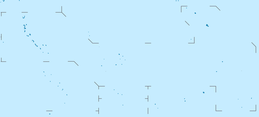
Deutsch: Positionskarte von Kiribati
Quadratische Plattkarte. Geographische Begrenzung der Karte:
English: Location map of Kiribati
Equirectangular projection. Geographic limits of the map:
|
|
| စၟတ်တ္ၚဲ | ||
| တမ်ရိုဟ် |
ကမၠောန် ဇကုအပိုင်, using
|
|
| ကဝိ | NordNordWest | |
| တင်မကဵုအခေါင် (ကလေင်သုင်စောဲ ဝှာင်ဏအ်) |
ဤဖိုင်သည် Creative Commons Attribution-Share Alike 3.0 ဂျာမနီ လိုင်စင်အောက်တွင် လိုင်စင်သတ်မှတ်ထားပါသည်။
 ဤဖိုင်သည် Creative Commons Attribution-Share Alike 3.0 ဂျာမနီ လိုင်စင်အောက်တွင် လိုင်စင်သတ်မှတ်ထားပါသည်။
|
|
| အခြား ဗားရှင်းများ |
|


|
This map has been made or improved in the German Kartenwerkstatt (Map Lab). You can propose maps to improve as well.
|
ဝှာင် လၟေင်အပြံင်အလှာဲ
ဍဵု လတူ စၟတ်တ္ၚဲ/အခိင် မွဲမွဲ သွက်ဂွံ ထ္ၜးကဵု ဝှာင် မကတဵုဒှ်လဝ် ပ္ဍဲအခိင်ဂှ်၊၊
| စၟတ်တ္ၚဲ/အခိင် | ဗီုပြင်နမူနာ | ပမာဏ | ညးလွပ် | တင်ပသောင်ကလး | |
|---|---|---|---|---|---|
| လၟုဟ် | ၂၂:၂၂၊ ၂၃ ဖေဖဝ်ဝါရဳ ၂၀၂၁ | | ၁၄၈၈ × ၆၇၃ (၆၈ KB) | NordNordWest | Reverted to version as of 09:54, 1 April 2010 (UTC), sorry, but this is not location map style |
| ၁၉:၃၈၊ ၂၃ ဖေဖဝ်ဝါရဳ ၂၀၂၁ |  | ၁၄၈၈ × ၆၇၃ (၁၃၇ KB) | Amitchell125 | borders made visible with minor corrections | |
| ၁၆:၂၄၊ ၁ ဨပြဳ ၂၀၁၀ |  | ၁၄၈၈ × ၆၇၃ (၆၈ KB) | NordNordWest | c | |
| ၀၂:၃၄၊ ၆ မာတ် ၂၀၁၀ |  | ၁၄၈၈ × ၆၇၃ (၈၄ KB) | NordNordWest | == {{int:filedesc}} == {{Information |Description= {{de|Positionskarte von Kiribati}} Quadratische Plattkarte. Geographische Begrenzung der Karte: * N: 6° N * S: 13° S * W: 169° O * O: 149° W {{en|Location map of [[:en:Kiribati|Kiriba |
ဝှာင် ဗီုဂွံစကာ
မုက်လိက် မရပ်စပ် ဝှာင်ဏအ် ဟွံမဲ၊၊
ဝှာင် သွက်ဂွံသုင်စောဲ ဂလုပ်ဗဴ
ဗွဲသၟဝ်ဏအ်ဂှ် ဒှ်အရာ ဝဳကဳတၞဟ် မစကာလဝ် ဝှာင်ဏအ်၊၊
- ဗီုစကာ ပ္ဍဲ af.wikipedia.org
- ဗီုစကာ ပ္ဍဲ als.wikipedia.org
- ဗီုစကာ ပ္ဍဲ an.wikipedia.org
- ဗီုစကာ ပ္ဍဲ ar.wikipedia.org
- ဗီုစကာ ပ္ဍဲ ast.wikipedia.org
- ဗီုစကာ ပ္ဍဲ az.wikipedia.org
- ဗီုစကာ ပ္ဍဲ ba.wikipedia.org
- ဗီုစကာ ပ္ဍဲ be-tarask.wikipedia.org
- ဗီုစကာ ပ္ဍဲ be.wikipedia.org
- ဗီုစကာ ပ္ဍဲ bg.wikipedia.org
- ဗီုစကာ ပ္ဍဲ bh.wikipedia.org
- ဗီုစကာ ပ္ဍဲ bn.wikipedia.org
- ဗီုစကာ ပ္ဍဲ bs.wikipedia.org
- ဗီုစကာ ပ္ဍဲ ceb.wikipedia.org
ဗဵု more global usage ဝှာင်ဏအ်၊၊