
ဝှာင်:Mehrgarh pakistan rel96.JPG
ဇမၞော် နမူနာ ဏအ် - ၄၈၉ × ၆၀၀ pixels အရာမသ္ဂုတ်သွာတ်လဝ်ဂမၠိုၚ်: ၁၉၆ × ၂၄၀ pixels | ၃၉၁ × ၄၈၀ pixels | ၉၇၈ × ၁၁၉၉ pixels တၞဟ်။
ဝှာင် တမ်မူလ (၉၇၈ × ၁၁၉၉ pixels, file size: ၅၇၃ KB, MIME type: image/jpeg)
သကေမ်
| ကဵုယၟု |
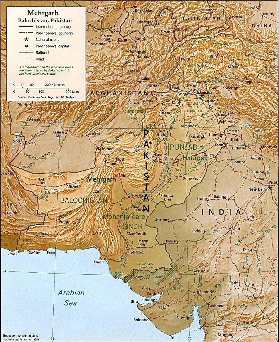
English: This is an annotated version of a relief map of Pakistan in the public domain([1]). The map was annotated by Fowler&fowler«Talk» 08:07, 7 March 2007 (UTC) and rereleased to the public domain. |
| စၟတ်တ္ၚဲ | ၇ မာတ် ၂၀၀၇ (original upload date) |
| တမ်ရိုဟ် | Transferred from en.wikipedia to Commons. |
| ကဝိ | Fowler&fowler at အင်္ဂလိက် ဝဳကဳပဳဒဳယာ |
မသ္ဂုတ်သွာတ်လာင်ဇြေန်
| This work has been released into the public domain by its author, Fowler&fowler at အင်္ဂလိက် ဝဳကဳပဳဒဳယာ. This applies worldwide. In some countries this may not be legally possible; if so: Fowler&fowler grants anyone the right to use this work for any purpose, without any conditions, unless such conditions are required by law. |
မူရင်းတင်ထားသောမှတ်တမ်း
The original description page was here. All following user names refer to en.wikipedia.
- 2007-03-07 08:07 Fowler&fowler 1104×1332×8 (363580 bytes) This is an annotated version of a relief map of Pakistan in the public domain([http://www.lib.utexas.edu/maps/faq.html]). The map was annotated by ~~~~ and rereleased to the public domain. {{PD-self}}
- 2007-03-07 08:07 Fowler&fowler 1104×1332×8 (363580 bytes) This is an annotated version of a relief map of Pakistan in the public domain([http://www.lib.utexas.edu/maps/faq.html]). The map was annotated by ~~~~ and rereleased to the public domain. {{PD-self}}
ဝှာင် လၟေင်အပြံင်အလှာဲ
ဍဵု လတူ စၟတ်တ္ၚဲ/အခိင် မွဲမွဲ သွက်ဂွံ ထ္ၜးကဵု ဝှာင် မကတဵုဒှ်လဝ် ပ္ဍဲအခိင်ဂှ်၊၊
| စၟတ်တ္ၚဲ/အခိင် | ဗီုပြင်နမူနာ | ပမာဏ | ညးလွပ် | တင်ပသောင်ကလး | |
|---|---|---|---|---|---|
| လၟုဟ် | ၀၂:၀၁၊ ၂၁ သေပ်တေမ်ဗါ ၂၀၁၁ | | ၉၇၈ × ၁၁၉၉ (၅၇၃ KB) | Fowler&fowler | Correcting position of Mehrgarh (which had been placed incorrectly by me in the previous version). ~~~~ |
| ၀၁:၄၇၊ ၂၄ ဇာန်နဝါရဳ ၂၀၀၈ |  | ၁၁၀၄ × ၁၃၃၂ (၃၅၅ KB) | File Upload Bot (Magnus Manske) | {{BotMoveToCommons|en.wikipedia}} {{Information |Description={{en|This is an annotated version of a relief map of Pakistan in the public domain([http://www.lib.utexas.edu/maps/faq.html]). The map was annotated by [[:en:User:Fowler&fowler|<font color |
ဝှာင် ဗီုဂွံစကာ
မုက်လိက် မရပ်စပ် ဝှာင်ဏအ် ဟွံမဲ၊၊
ဝှာင် သွက်ဂွံသုင်စောဲ ဂလုပ်ဗဴ
ဗွဲသၟဝ်ဏအ်ဂှ် ဒှ်အရာ ဝဳကဳတၞဟ် မစကာလဝ် ဝှာင်ဏအ်၊၊
- ဗီုစကာ ပ္ဍဲ arz.wikipedia.org
- ဗီုစကာ ပ္ဍဲ be.wikipedia.org
- ဗီုစကာ ပ္ဍဲ cs.wikipedia.org
- ဗီုစကာ ပ္ဍဲ da.wikipedia.org
- ဗီုစကာ ပ္ဍဲ en.wikipedia.org
- ဗီုစကာ ပ္ဍဲ eo.wikipedia.org
- ဗီုစကာ ပ္ဍဲ hi.wikipedia.org
- ဗီုစကာ ပ္ဍဲ incubator.wikimedia.org
- ဗီုစကာ ပ္ဍဲ ja.wikipedia.org
- ဗီုစကာ ပ္ဍဲ ka.wikipedia.org
- ဗီုစကာ ပ္ဍဲ ko.wikipedia.org
- ဗီုစကာ ပ္ဍဲ lt.wikipedia.org
- ဗီုစကာ ပ္ဍဲ ne.wikipedia.org
- ဗီုစကာ ပ္ဍဲ nn.wikipedia.org
- ဗီုစကာ ပ္ဍဲ no.wikipedia.org
- ဗီုစကာ ပ္ဍဲ pa.wikipedia.org
- ဗီုစကာ ပ္ဍဲ pnb.wikipedia.org
- ဗီုစကာ ပ္ဍဲ pt.wikipedia.org
- ဗီုစကာ ပ္ဍဲ sq.wikipedia.org
- ဗီုစကာ ပ္ဍဲ sv.wikipedia.org
- ဗီုစကာ ပ္ဍဲ ta.wikipedia.org
- ဗီုစကာ ပ္ဍဲ te.wikipedia.org
- ဗီုစကာ ပ္ဍဲ ur.wikipedia.org
- ဗီုစကာ ပ္ဍဲ vi.wikipedia.org
- ဗီုစကာ ပ္ဍဲ www.wikidata.org
- ဗီုစကာ ပ္ဍဲ xmf.wikipedia.org