
ဝှာင်:Somerset UK location map.svg

Size of this PNG preview of this SVG file: ၈၀၀ × ၅၀၆ pixels. အရာမသ္ဂုတ်သွာတ်လဝ်ဂမၠိုၚ်: ၃၂၀ × ၂၀၂ pixels | ၆၄၀ × ၄၀၅ pixels | ၁၀၂၄ × ၆၄၇ pixels | ၁၂၈၀ × ၈၀၉ pixels | ၂၅၆၀ × ၁၆၁၉ pixels | ၁၄၂၅ × ၉၀၁ pixels တၞဟ်။
ဝှာင် တမ်မူလ (SVG ဝှာင်, မိက်ကဵုကသပ် ၁၄၂၅ × ၉၀၁ pixels, ဇမၞော် ဝှာင်: ၂.၃၈ MB)
| ကဵုယၟု |
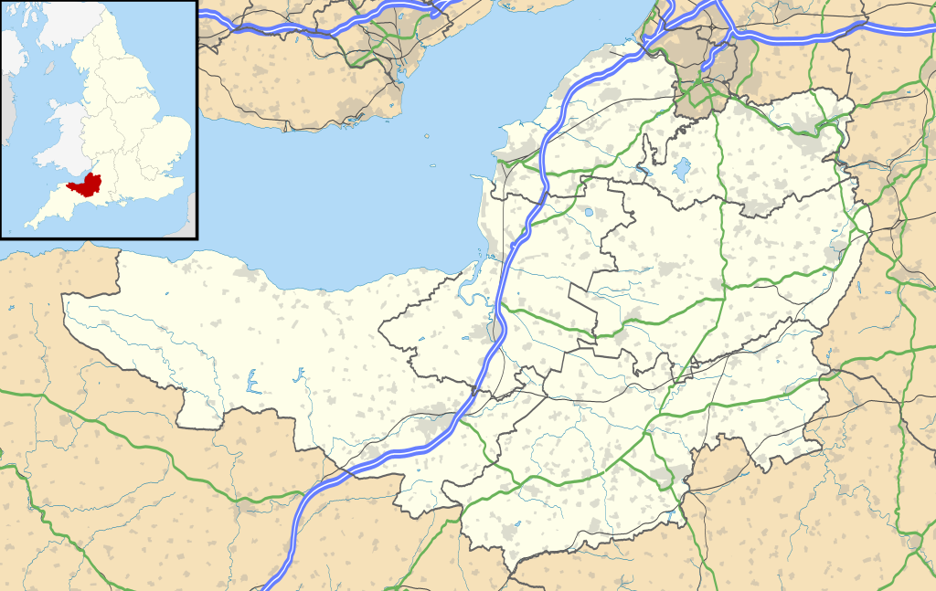
Map of Somerset, UK with the following information shown:
Equirectangular map projection on WGS 84 datum, with N/S stretched 155% Geographic limits:
|
| စၟတ်တ္ၚဲ | |
| တမ်ရိုဟ် |
|
| ကဝိ | Nilfanion, created using Ordnance Survey data |
| တင်မကဵုအခေါင် (ကလေင်သုင်စောဲ ဝှာင်ဏအ်) |
ဝှာင်ဏအ်ဂှ် စၟတ်သမ္တီလဝ် နကဵုလာင်ဇြေန် Creative Commons Attribution-Share Alike 3.0 Unported ရ၊၊ ဒဒှ်မစၟတ်သမ္တီကေတ်: Contains Ordnance Survey data © Crown copyright and database right
|
| အခြား ဗားရှင်းများ | File:Somerset UK district map (blank).svg - Blank map |
.svg)
ဝှာင် လၟေင်အပြံင်အလှာဲ
ဍဵု လတူ စၟတ်တ္ၚဲ/အခိင် မွဲမွဲ သွက်ဂွံ ထ္ၜးကဵု ဝှာင် မကတဵုဒှ်လဝ် ပ္ဍဲအခိင်ဂှ်၊၊
| စၟတ်တ္ၚဲ/အခိင် | ဗီုပြင်နမူနာ | ပမာဏ | ညးလွပ် | တင်ပသောင်ကလး | |
|---|---|---|---|---|---|
| လၟုဟ် | ၀၁:၅၃၊ ၁၈ ဇာန်နဝါရဳ ၂၀၂၀ | | ၁၄၂၅ × ၉၀၁ (၂.၃၈ MB) | The Equalizer | Updated district borders (Somerset West and Taunton) |
| ၀၁:၄၂၊ ၂၇ သေပ်တေမ်ဗါ ၂၀၁၀ |  | ၁၄၂၅ × ၉၀၁ (၂.၃၆ MB) | Nilfanion | {{Information |Description=Map of Somerset, UK with the following information shown: *Administrative borders *Coastline, lakes and rivers *Roads and railways *Urban areas Equirectangular map projection on WGS 84 datum, with N/S stretched 1 |
ဝှာင် ဗီုဂွံစကာ
မုက်လိက် မရပ်စပ် ဝှာင်ဏအ် ဟွံမဲ၊၊
ဝှာင် သွက်ဂွံသုင်စောဲ ဂလုပ်ဗဴ
ဗွဲသၟဝ်ဏအ်ဂှ် ဒှ်အရာ ဝဳကဳတၞဟ် မစကာလဝ် ဝှာင်ဏအ်၊၊
- ဗီုစကာ ပ္ဍဲ ar.wikipedia.org
- ဗီုစကာ ပ္ဍဲ arz.wikipedia.org
- ဗီုစကာ ပ္ဍဲ bg.wikipedia.org
- ဗီုစကာ ပ္ဍဲ bh.wikipedia.org
- ဗီုစကာ ပ္ဍဲ bn.wikipedia.org
- টেমপ্লেট:তথ্যছক ঐতিহাসিক স্থান
- ডানস্টারের চলমান ওয়াটারমিল
- স্টোনি লিটলটন লং ব্যারৌ
- ট্রেজারস হাউজ
- ব্ল্যাকফোর্ড ফার্মের পায়রার বাসা
- ডানস্টের বাটার ক্রুশ
- টিনটিনহাল বাগান
- টেমপ্লেট:তথ্যছক বিশেষ বৈজ্ঞানিক আগ্রহের সাইট
- মডিউল:অবস্থান মানচিত্র/উপাত্ত/যুক্তরাজ্য সমারসেট
- মডিউল:অবস্থান মানচিত্র/উপাত্ত/যুক্তরাজ্য সমারসেট/নথি
- মডিউল:অবস্থান মানচিত্র/উপাত্ত/সমারসেট
- মডিউল:অবস্থান মানচিত্র/উপাত্ত/সমারসেট/নথি
- টেমপ্লেট:তথ্যছক বিশেষ বৈজ্ঞানিক আগ্রহের সাইট/নথি
- টেমপ্লেট:তথ্যছক ঐতিহাসিক স্থান/নথি
- ব্রিস্টল বিমানবন্দর
- মডিউল:অবস্থান মানচিত্র/উপাত্ত/সোমারসেট
- মডিউল:অবস্থান মানচিত্র/উপাত্ত/সোমারসেট/নথি
- ဗီုစကာ ပ္ဍဲ ceb.wikipedia.org
- ဗီုစကာ ပ္ဍဲ dty.wikipedia.org
- ဗီုစကာ ပ္ဍဲ en.wikipedia.org
- Cheddar, Somerset
- Wookey Hole Caves
- Bath, Somerset
- Wells, Somerset
- Bridgwater
- Glastonbury
- Shepton Mallet
- Bath Abbey
- Glastonbury Festival
- American Museum and Gardens
- Glastonbury Tor
- Nether Stowey
- Street, Somerset
- Sieges of Taunton
- Taunton
- Athelney
- North Petherton
- Bridgwater Bay
- Puriton
- Weston-super-Mare
- Yeovil
- Frome
- Clevedon
- Solsbury Hill
ဗဵု more global usage ဝှာင်ဏအ်၊၊