
ဝှာင်:Txu-oclc-10552568-nh48-6.jpg
ဇမၞော် နမူနာ ဏအ် - ၇၈၅ × ၅၉၉ pixels အရာမသ္ဂုတ်သွာတ်လဝ်ဂမၠိုၚ်: ၃၁၅ × ၂၄၀ pixels | ၆၂၉ × ၄၈၀ pixels | ၁၀၀၆ × ၇၆၈ pixels | ၁၂၈၀ × ၉၇၇ pixels | ၂၅၆၀ × ၁၉၅၄ pixels | ၅၀၀၀ × ၃၈၁၇ pixels တၞဟ်။
ဝှာင် တမ်မူလ (၅၀၀၀ × ၃၈၁၇ pixels, file size: ၅.၇ MB, MIME type: image/jpeg)
သကေမ်
| ကဵုယၟု |
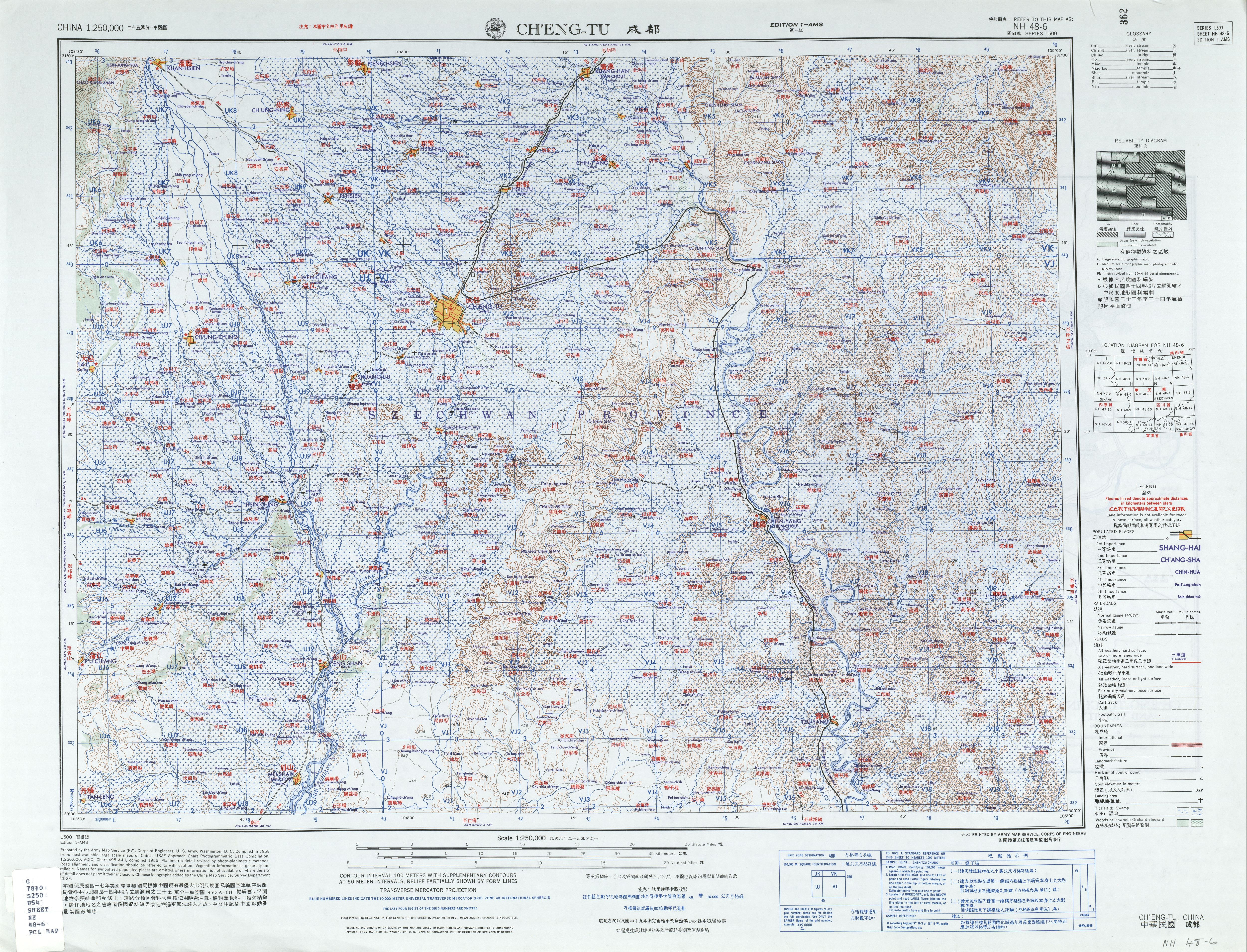
English: Chengdu (Chʻeng-tu), Sichuan, China and surrounding region AMS Topographic Maps |
| စၟတ်တ္ၚဲ |
Compiled: 1958 Printed: August 1963 |
| တမ်ရိုဟ် | Courtesy of the University of Texas Libraries, The University of Texas at Austin. (NH 48-6) |
| ကဝိ | Army Map Service, Corps of Engineers |
မသ္ဂုတ်သွာတ်လာင်ဇြေန်
This image or file is a work of a U.S. Army Corps of Engineers soldier or employee, taken or made as part of that person's official duties. As a work of the U.S. federal government, the image is in the public domain.
|
ဝှာင် လၟေင်အပြံင်အလှာဲ
ဍဵု လတူ စၟတ်တ္ၚဲ/အခိင် မွဲမွဲ သွက်ဂွံ ထ္ၜးကဵု ဝှာင် မကတဵုဒှ်လဝ် ပ္ဍဲအခိင်ဂှ်၊၊
| စၟတ်တ္ၚဲ/အခိင် | ဗီုပြင်နမူနာ | ပမာဏ | ညးလွပ် | တင်ပသောင်ကလး | |
|---|---|---|---|---|---|
| လၟုဟ် | ၁၁:၂၅၊ ၁၃ သေပ်တေမ်ဗါ ၂၀၁၉ | | ၅၀၀၀ × ၃၈၁၇ (၅.၇ MB) | Geographyinitiative | User created page with UploadWizard |
ဝှာင် ဗီုဂွံစကာ
မုက်လိက် မရပ်စပ် ဝှာင်ဏအ် ဟွံမဲ၊၊
ဝှာင် သွက်ဂွံသုင်စောဲ ဂလုပ်ဗဴ
ဗွဲသၟဝ်ဏအ်ဂှ် ဒှ်အရာ ဝဳကဳတၞဟ် မစကာလဝ် ဝှာင်ဏအ်၊၊