
ဝှာင်:USA location map.svg

Size of this PNG preview of this SVG file: ၈၀၀ × ၄၁၇ pixels. အရာမသ္ဂုတ်သွာတ်လဝ်ဂမၠိုၚ်: ၃၂၀ × ၁၆၇ pixels | ၆၄၀ × ၃၃၃ pixels | ၁၀၂၄ × ၅၃၃ pixels | ၁၂၈၀ × ၆၆၇ pixels | ၂၅၆၀ × ၁၃၃၃ pixels | ၁၈၅၉ × ၉၆၈ pixels တၞဟ်။
ဝှာင် တမ်မူလ (SVG ဝှာင်, မိက်ကဵုကသပ် ၁၈၅၉ × ၉၆၈ pixels, ဇမၞော် ဝှာင်: ၇၂၁ KB)
သကေမ်
| ကဵုယၟု |
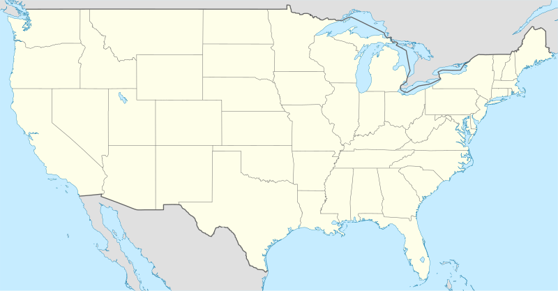
Deutsch: Positionskarte der Vereinigten Staaten („lower 48“)
Quadratische Plattkarte, N-S-Streckung 120 %. Geographische Begrenzung der Karte:
English: Location map of the United States ("lower 48")
Equirectangular projection, N/S stretching 120 %. Geographic limits of the map:
Italiano: Mappa di localizzazione degli Stati Uniti d'America ("lower 48")
Proiezione equirettangolare, stiramento N/S 120 %. Limiti geografici della mappa:
|
| စၟတ်တ္ၚဲ | |
| တမ်ရိုဟ် |
own work, using
|
| ကဝိ | NordNordWest |
| အခြား ဗားရှင်းများ |
Derivative works of this file: |

|
This map has been made or improved in the German Kartenwerkstatt (Map Lab). You can propose maps to improve as well.
|
မသ္ဂုတ်သွာတ်လာင်ဇြေန်
ကျွန်ုပ်၊ ဤလုပ်ဆောင်ချက်၏ မူပိုင်ခွင့်ပိုင်ရှင်အနေဖြင့် ဤနေရာမှ အောက်ပါလိုင်စင်များအောက်တွင် ထုတ်လွှင့်ပါသည်:

|
လိက်တအ်ဂှ် သၠးကဵုလဝ် အခေါင် သွက်ဂွံ စၠောအ်ကပ်ပဳ၊ ပရး ကီု သီုကဵု ပလေဝ်ပခိုဟ်ပတိုန် အတိုင်သၞောတ်ဝ် GNU Free Documentation License, တုဲ မူ ၁.၂ ဟွံသေင်မ္ဂး မူတြေံနူဂှ် မတြးပတိတ် နကဵု သၞောတ်ဝ်လာင်ဇြေန် Free Software Foundation; with no Invariant Sections, no Front-Cover Texts, and no Back-Cover Texts. A copy of the license is included in the section entitled GNU Free Documentation License. |
ဝှာင်ဏအ်ဂှ် စၟတ်သမ္တီလဝ် နကဵုလာင်ဇြေန် Creative Commons Attribution-Share Alike 3.0 Unported ရ၊၊
- မၞးဂှ် ဗွဲမဗၠးၜး -
- သွက်ဂွံ ပါ်ပရအ် – သွက်ဂွံ စၠောအ်ပပ်ပဳ၊ တြးပတိတ်၊ ဗလး ကမၠောန်
- သွက်ဂွံ ပကောံနှဴ – သွက်ဂွံ ပလေဝ်ပညဳ ကမၠောန်
- နကဵု တင်မသ္ဒးဒ္ဂေတ်ဗက် ဗွဲသၟဝ်ဏအ်ဂှ်
- တင်မစှ်ေစိုတ် – မၞး သ္ဒးဒ္ဂေတ်ဗက် သၞောတ်ဝ် မဖျေဟ်လဝ် စပ်ကဵု အစာချူလိက် ဟွံသေင်မ္ဂး တၠမူတအ်ရောင်၊၊ (ဆဂး နကဵုနဲလဵု အကာဲအရာ ဗီုလဵုလေဝ် ဟွံကဵုကသပ် ဟွံထံက်ဂလာန် ကုမၞး ပ္ဍဲအရာမစကာ ဒြပ်ညးတၞဟ်တအ်ရောင်)။
- ပါ်ပရအ် အရာမတုပ်သၟဟ် – ယဝ်ရ မၞး ပလေဝ်၊ ပြံင်လှာဲ ဟွံသေင်မ္ဂး ထပ်ခၞံဗဒှ်တၟိမ္ဂး အရာကမၠောန်တအ် သီုဖအိုတ်ဂှ် သ္ဒးပရးပတိတ် နကဵုသၟဝ် မတုပ် ဟွံသေင်မ္ဂး မသၟဟ် ကုလာင်ဇြေန် ကမၠောန်တြေံဂှ် ဟေင်ရ၊၊
လာင်ဇြေန် မၞး မၞုံပၟိက်ဂှ် မၞးရုဲစှ်ကေတ် မာန်ရ၊၊
ဝှာင် လၟေင်အပြံင်အလှာဲ
ဍဵု လတူ စၟတ်တ္ၚဲ/အခိင် မွဲမွဲ သွက်ဂွံ ထ္ၜးကဵု ဝှာင် မကတဵုဒှ်လဝ် ပ္ဍဲအခိင်ဂှ်၊၊
| စၟတ်တ္ၚဲ/အခိင် | ဗီုပြင်နမူနာ | ပမာဏ | ညးလွပ် | တင်ပသောင်ကလး | |
|---|---|---|---|---|---|
| လၟုဟ် | ၀၂:၃၄၊ ၃၀ ဂျူလာင် ၂၀၀၈ | | ၁၈၅၉ × ၉၆၈ (၇၂၁ KB) | NordNordWest | {{Information |Description= {{de|Positionskarte der Vereinigten Staaten}} Quadratische Plattkarte, N-S-Streckung 120 %. Geographische Begrenzung der Karte: * N: 49.8° N * S: 24.2° N * W: 125.5° W * O: 66.5° W {{en|Location m |
ဝှာင် ဗီုဂွံစကာ
မုက်လိက် မရပ်စပ် ဝှာင်ဏအ် ဟွံမဲ၊၊
ဝှာင် သွက်ဂွံသုင်စောဲ ဂလုပ်ဗဴ
ဗွဲသၟဝ်ဏအ်ဂှ် ဒှ်အရာ ဝဳကဳတၞဟ် မစကာလဝ် ဝှာင်ဏအ်၊၊
- ဗီုစကာ ပ္ဍဲ af.wikipedia.org
- ဗီုစကာ ပ္ဍဲ am.wikipedia.org
- ဗီုစကာ ပ္ဍဲ ar.wikipedia.org
- ဗီုစကာ ပ္ဍဲ arz.wikipedia.org
- ဗီုစကာ ပ္ဍဲ as.wikipedia.org
- ဗီုစကာ ပ္ဍဲ azb.wikipedia.org
- ဗီုစကာ ပ္ဍဲ be-tarask.wikipedia.org
- Саўт-Рывэр
- Нью-Ёрк
- Вашынгтон (акруга Калюмбія)
- Чыкага
- Лос-Анджэлес
- Лас-Вэгас
- Пітсбург (Пэнсыльванія)
- Філадэлфія
- Сіетл
- Г’юстан
- Далас
- Фінікс (Арызона)
- Сан-Антоніё
- Сан-Дыега
- Дэтройт
- Сан-Хасэ (Каліфорнія)
- Індыянапаліс
- Джэксанвіль
- Каламбус
- Калюмбійскі ўнівэрсытэт
- Рэдынг (Пэнсыльванія)
- Тэрарыстычныя акты 11 верасьня 2001 году
- Маўнтын-Вію (Каліфорнія)
- Мэнла-Парк (Каліфорнія)
ဗဵု more global usage ဝှာင်ဏအ်၊၊