
ဝှာင်:United Kingdom relief location map.jpg

ဇမၞော် နမူနာ ဏအ် - ၃၈၈ × ၆၀၀ pixels အရာမသ္ဂုတ်သွာတ်လဝ်ဂမၠိုၚ်: ၁၅၅ × ၂၄၀ pixels | ၃၁၀ × ၄၈၀ pixels | ၄၉၇ × ၇၆၈ pixels | ၆၆၂ × ၁၀၂၄ pixels | ၁၃၄၈ × ၂၀၈၃ pixels တၞဟ်။
ဝှာင် တမ်မူလ (၁၃၄၈ × ၂၀၈၃ pixels, file size: ၈၃၁ KB, MIME type: image/jpeg)
Du
သကေမ်
| ကဵုယၟု |
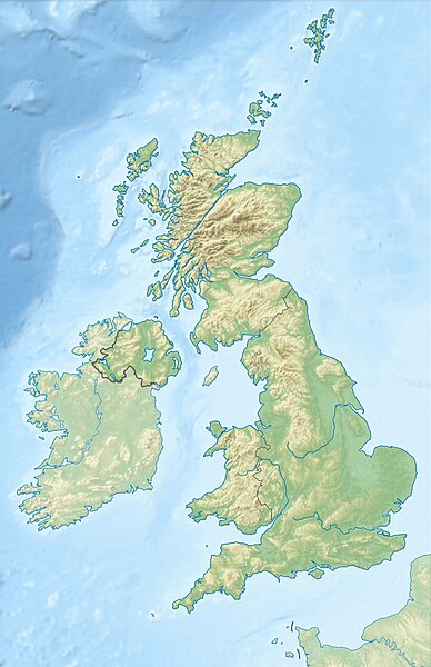
Deutsch: Positionskarte des Vereinigten Königreichs
Quadratische Plattkarte, N-S-Streckung 170 %. Geographische Begrenzung der Karte:
English: Location map of the United Kingdom
Equirectangular projection, N/S stretching 170 %. Geographic limits of the map:
|
| စၟတ်တ္ၚဲ | |
| တမ်ရိုဟ် |
own work, using SRTM Data, |
| ကဝိ | Alexrk2 |
| အခြား ဗားရှင်းများ |
|


|
This map has been made or improved in the German Kartenwerkstatt (Map Lab). You can propose maps to improve as well.
|
ПРИВЕТ ВСЕМ
မသ္ဂုတ်သွာတ်လာင်ဇြေန်
ကျွန်ုပ်၊ ဤလုပ်ဆောင်ချက်၏ မူပိုင်ခွင့်ပိုင်ရှင်အနေဖြင့် ဤနေရာမှ အောက်ပါလိုင်စင်များအောက်တွင် ထုတ်လွှင့်ပါသည်:

|
လိက်တအ်ဂှ် သၠးကဵုလဝ် အခေါင် သွက်ဂွံ စၠောအ်ကပ်ပဳ၊ ပရး ကီု သီုကဵု ပလေဝ်ပခိုဟ်ပတိုန် အတိုင်သၞောတ်ဝ် GNU Free Documentation License, တုဲ မူ ၁.၂ ဟွံသေင်မ္ဂး မူတြေံနူဂှ် မတြးပတိတ် နကဵု သၞောတ်ဝ်လာင်ဇြေန် Free Software Foundation; with no Invariant Sections, no Front-Cover Texts, and no Back-Cover Texts. A copy of the license is included in the section entitled GNU Free Documentation License. |
ဝှာင်ဏအ်ဂှ် စၟတ်သမ္တီလဝ် နကဵုလာင်ဇြေန် Creative Commons Attribution-Share Alike 3.0 Unported ရ၊၊
- မၞးဂှ် ဗွဲမဗၠးၜး -
- သွက်ဂွံ ပါ်ပရအ် – သွက်ဂွံ စၠောအ်ပပ်ပဳ၊ တြးပတိတ်၊ ဗလး ကမၠောန်
- သွက်ဂွံ ပကောံနှဴ – သွက်ဂွံ ပလေဝ်ပညဳ ကမၠောန်
- နကဵု တင်မသ္ဒးဒ္ဂေတ်ဗက် ဗွဲသၟဝ်ဏအ်ဂှ်
- တင်မစှ်ေစိုတ် – မၞး သ္ဒးဒ္ဂေတ်ဗက် သၞောတ်ဝ် မဖျေဟ်လဝ် စပ်ကဵု အစာချူလိက် ဟွံသေင်မ္ဂး တၠမူတအ်ရောင်၊၊ (ဆဂး နကဵုနဲလဵု အကာဲအရာ ဗီုလဵုလေဝ် ဟွံကဵုကသပ် ဟွံထံက်ဂလာန် ကုမၞး ပ္ဍဲအရာမစကာ ဒြပ်ညးတၞဟ်တအ်ရောင်)။
- ပါ်ပရအ် အရာမတုပ်သၟဟ် – ယဝ်ရ မၞး ပလေဝ်၊ ပြံင်လှာဲ ဟွံသေင်မ္ဂး ထပ်ခၞံဗဒှ်တၟိမ္ဂး အရာကမၠောန်တအ် သီုဖအိုတ်ဂှ် သ္ဒးပရးပတိတ် နကဵုသၟဝ် မတုပ် ဟွံသေင်မ္ဂး မသၟဟ် ကုလာင်ဇြေန် ကမၠောန်တြေံဂှ် ဟေင်ရ၊၊
လာင်ဇြေန် မၞး မၞုံပၟိက်ဂှ် မၞးရုဲစှ်ကေတ် မာန်ရ၊၊
ဝှာင် လၟေင်အပြံင်အလှာဲ
ဍဵု လတူ စၟတ်တ္ၚဲ/အခိင် မွဲမွဲ သွက်ဂွံ ထ္ၜးကဵု ဝှာင် မကတဵုဒှ်လဝ် ပ္ဍဲအခိင်ဂှ်၊၊
| စၟတ်တ္ၚဲ/အခိင် | ဗီုပြင်နမူနာ | ပမာဏ | ညးလွပ် | တင်ပသောင်ကလး | |
|---|---|---|---|---|---|
| လၟုဟ် | ၀၀:၄၃၊ ၁၈ ဂျောန် ၂၀၁၂ | | ၁၃၄၈ × ၂၀၈၃ (၈၃၁ KB) | Alexrk2 | inland water |
| ၀၀:၄၂၊ ၁၈ ဂျောန် ၂၀၁၂ |  | ၁၃၅၄ × ၂၀၉၀ (၈၂၉ KB) | Alexrk2 | == {{int:filedesc}} == {{Information |Description= {{de|Positionskarte des Vereinigten Königreichs}} Quadratische Plattkarte, N-S-Streckung 170 %. Geographische Begrenzung der Karte: * N: 61.0° N * S: 49.0° N * W: 11.... |
ဝှာင် ဗီုဂွံစကာ
မုက်လိက် မရပ်စပ် ဝှာင်ဏအ် ဟွံမဲ၊၊
ဝှာင် သွက်ဂွံသုင်စောဲ ဂလုပ်ဗဴ
ဗွဲသၟဝ်ဏအ်ဂှ် ဒှ်အရာ ဝဳကဳတၞဟ် မစကာလဝ် ဝှာင်ဏအ်၊၊
- ဗီုစကာ ပ္ဍဲ ab.wikipedia.org
- ဗီုစကာ ပ္ဍဲ ar.wikipedia.org
- ဗီုစကာ ပ္ဍဲ arz.wikipedia.org
- ဗီုစကာ ပ္ဍဲ ast.wikipedia.org
- ဗီုစကာ ပ္ဍဲ azb.wikipedia.org
- ဗီုစကာ ပ္ဍဲ az.wikipedia.org
- Şablon:Yer xəritəsi Böyük Britaniya
- İrland dənizi
- Ben Nevis
- Pa-de-Kale boğazı
- Şimal boğazı
- Orkney adaları
- Lox Ness
- Arran (ada)
- Fer adası
- Qrampian dağları
- Flanan adaları
- Finqal mağarası
- Hebrid dənizi
- Kelt dənizi
- Menay boğazı
- Nort-Minç boğazı
- Pentlənd-Ferd boğazı
- Yell boğazı
- Lya-Kupe bərzəxi
- Böyük Britaniya (ada)
- Solent
- Leskov adası
- Kernqorms Milli Parkı
- Kembri dağları
- Llin yarımadası
- Ardnamerxan
- Kintayr yarımadası
- Qrinviç yarımadası
- Qauer yarımadası
- Lends End
- Trevos burnu
- Müqəddəs Yekaterina burnu
- Lizard burnu
- Ayona
ဗဵု more global usage ဝှာင်ဏအ်၊၊